Previous Spaceflight Launches
Filter by Agency, Locations or Vehicles
Show All Launches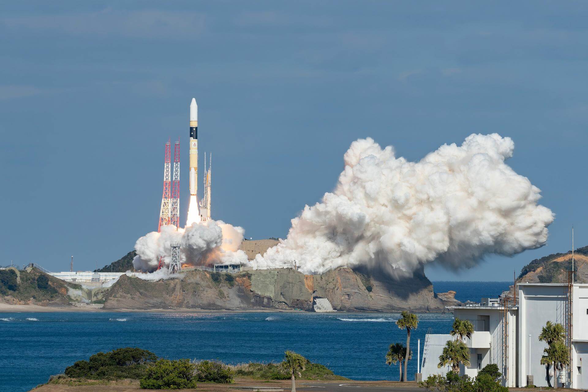
H-IIA 202 | IGS Optical 8
Mitsubishi Heavy Industries | JapanTanegashima Space Center, Japan
Jan. 12, 2024, 4:44 a.m.
Status: Launch Successful
Mission:
The IGS Optical 8 (Intelligence Gathering Satellite) is a Japanese optical reconnaissance satellite. The satellite is operated by the Cabinet Satellite Information Center. The satellite serves both Japan's national defense and civil natural disaster monitoring.
Sun-Synchronous Orbit
Gravity-1 | Maiden flight
Orienspace Technology | ChinaHaiyang Oriental Spaceport
Jan. 11, 2024, 5:30 a.m.
Status: Launch Successful
Mission:
First launch of Chinese private company OrienSpace's Gravity-1 launch vehicle from an ocean-going launch platform. Payload is Yunyao-1 18-20, 3 weather satellites performing atmospheric measurements using GNSS Radio Occultation for a Tianjin based company. Constellation is planned to have an eventual 90 satellites.
Low Earth Orbit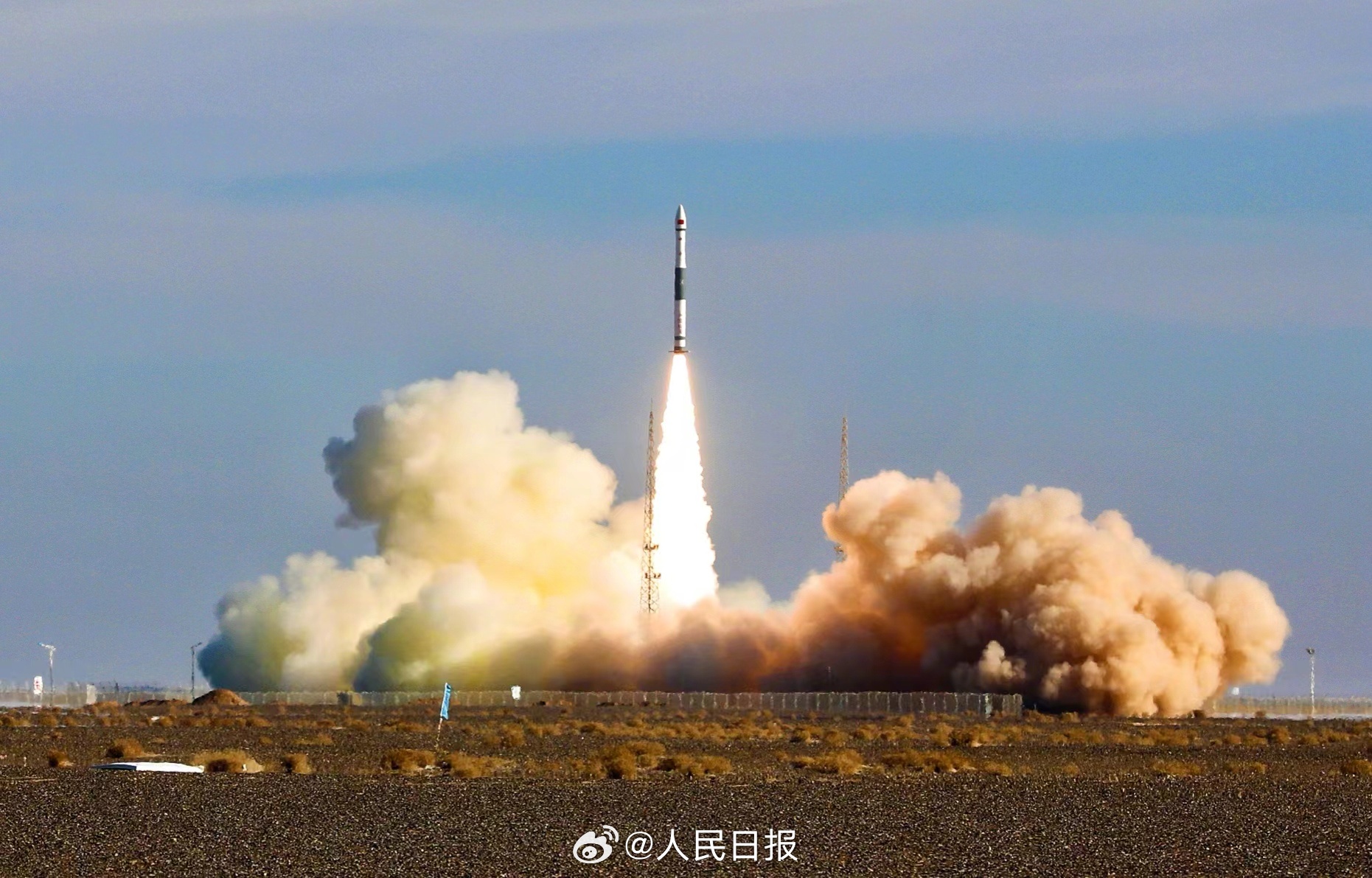
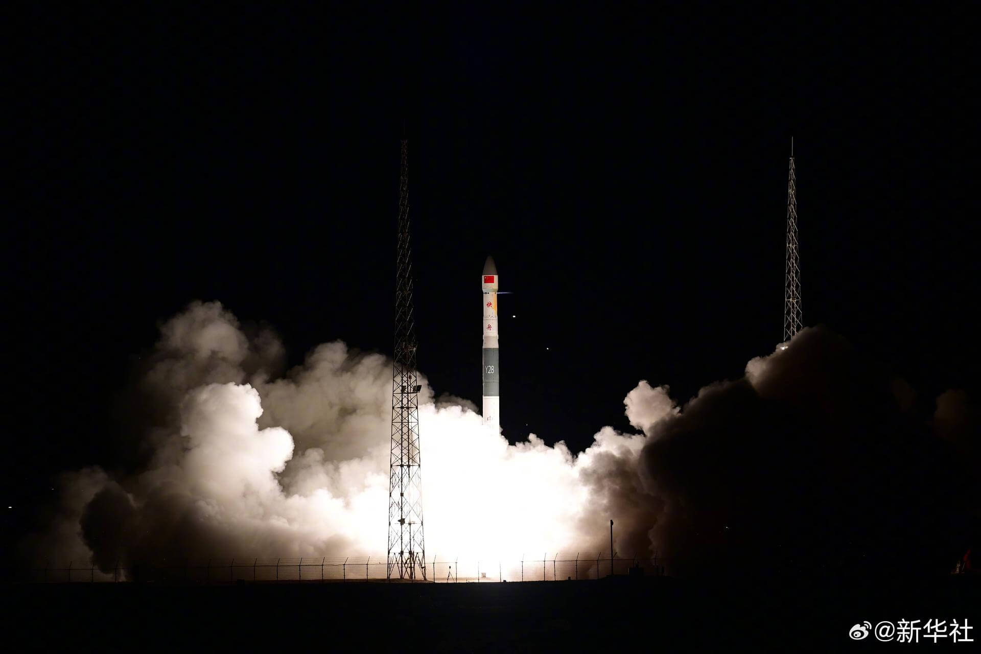
Kuaizhou 1A | Tianxing-1-02
ExPace | ChinaJiuquan Satellite Launch Center, People's Republic of China
Jan. 11, 2024, 3:52 a.m.
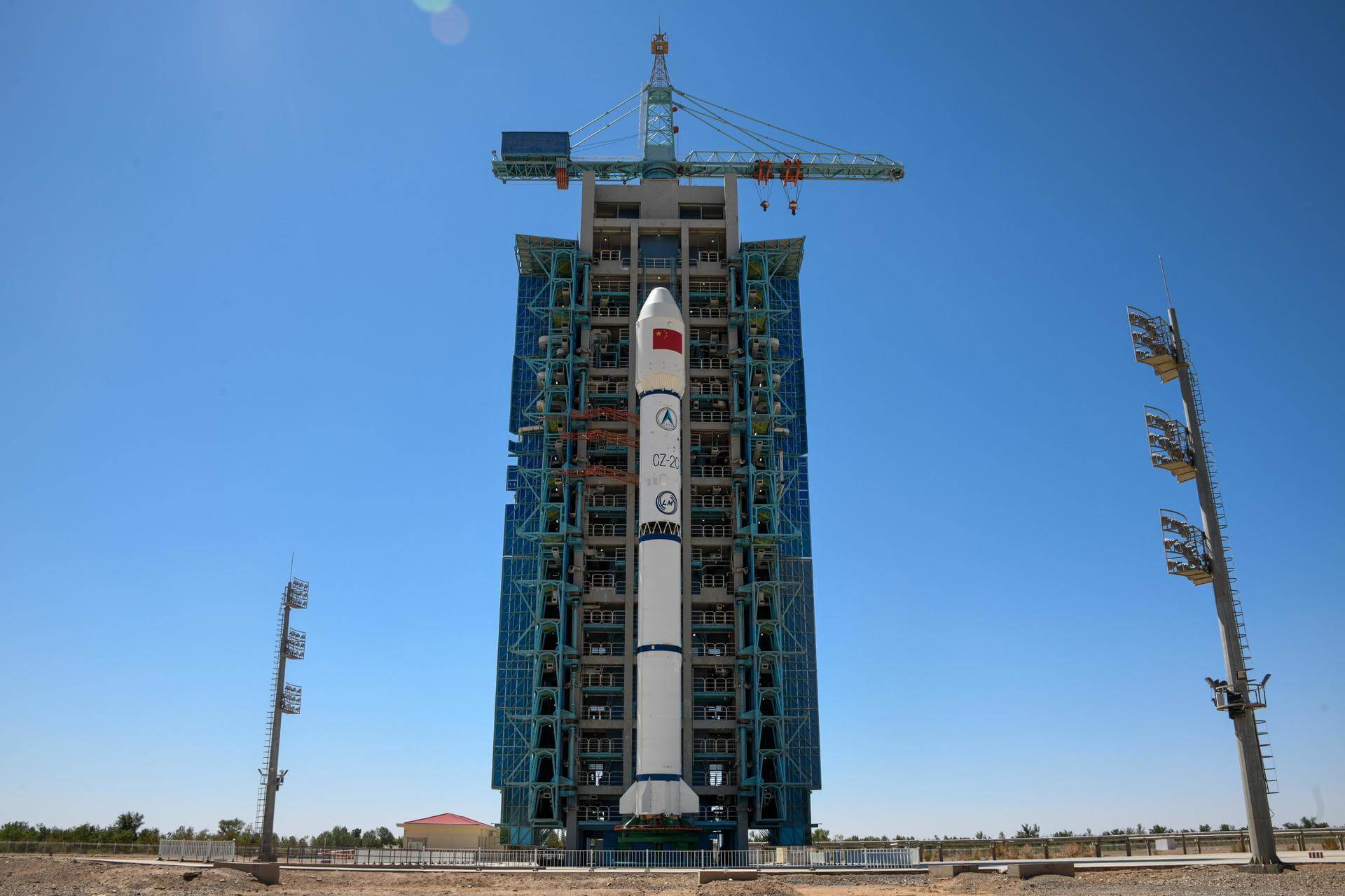
Long March 2C | Einstein Probe
China Aerospace Science and Technology Corporation | ChinaXichang Satellite Launch Center, People's Republic of China
Jan. 9, 2024, 7:03 a.m.
Status: Launch Successful
Mission:
The Einstein Probe (EP) is a Chinese Wide-Field X-ray astronomy observatory for detecting high energy flashes of cataclysmic cosmic events. These includes tidal disruption events (stars pulled apart by supermassive black holes), supernovae, and high-energy, electromagnetic counterparts of gravitational wave events. The spacecraft, weighing ~1400 kilograms, will be launched into a 600-kilometer-high, low-inclination orbit. The probe's instruments include a Wide-field X-ray Telescope (WXT) with a field of view of 3,600 square degrees, employing cutting-edge "lobster eye" optics to view X-ray events more deeply and widely than previously possible, and a Follow-up X-ray Telescope (FXT), developed in collaboration with Europe, that performs follow-up detailed observations as soon as WXT detects an X-ray event. The Einstein Probe mission is managed by the NSSC, with participation from the CAS's NAOC, the Institute of High Energy Physics (IHEP), the Shanghai Institute of Technical Physics (SITP), and the Innovation Academy for Microsatellites, a spacecraft manufacturer that has previously produced space science and Beidou navigation spacecraft. The European Space Agency is contributing to the mission with a mirror module for the FXT instrument, as well as ground station and science management support. The FXT instrument is also supported by Germany's Max Planck Institute for Extraterrestrial Physics.
Low Earth Orbit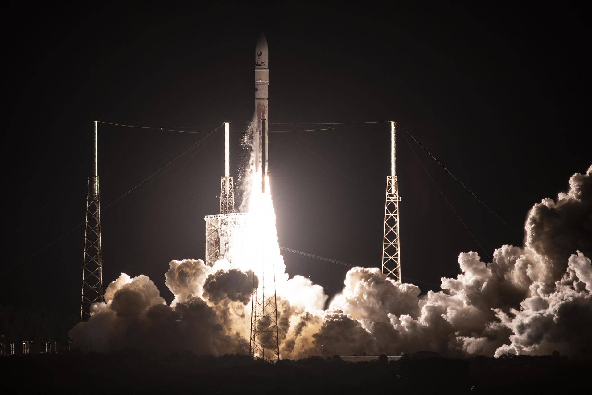
Vulcan VC2S | Peregrine lunar lander (Maiden flight)
United Launch Alliance | United States of AmericaCape Canaveral SFS, FL, USA
Jan. 8, 2024, 7:18 a.m.
Status: Launch Successful
Mission:
Maiden flight of ULA's Vulcan launch vehicle carrying the Peregrine lunar lander developed by Astrobotic Technology. Astrobotic was selected by NASA’s Commercial Lunar Payload Services (CLPS) program to deliver up to 14 NASA payloads to the Moon on its Peregrine lunar lander in 2022.
Lunar Orbit
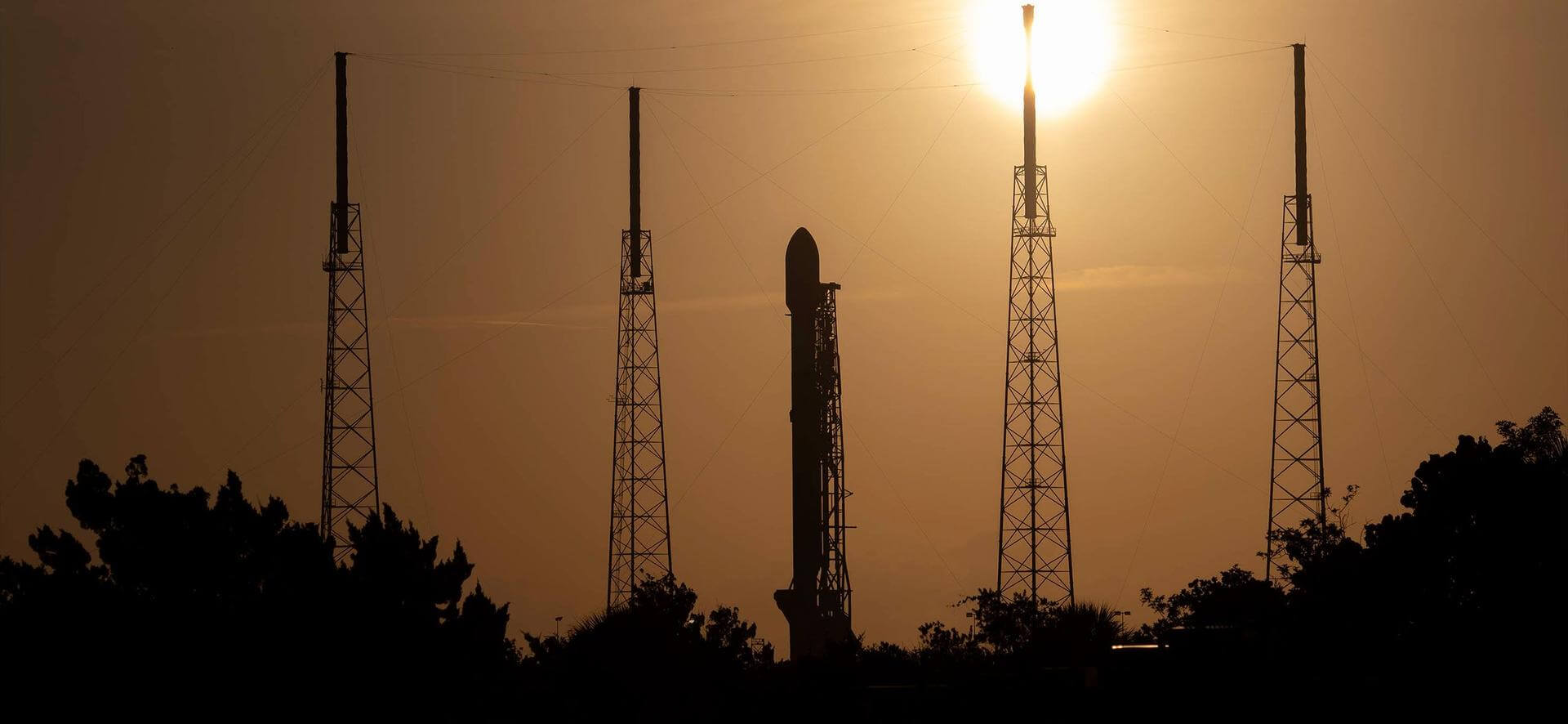
Falcon 9 Block 5 | Starlink Group 6-35
SpaceX | United States of AmericaCape Canaveral SFS, FL, USA
Jan. 7, 2024, 10:35 p.m.
Kuaizhou 1A | Tianmu-1 15-18
ExPace | ChinaJiuquan Satellite Launch Center, People's Republic of China
Jan. 5, 2024, 11:20 a.m.
Falcon 9 Block 5 | Ovzon-3
SpaceX | United States of AmericaCape Canaveral SFS, FL, USA
Jan. 3, 2024, 11:04 p.m.
Status: Launch Successful
Mission:
Ovzon 3 is a planned small communications satellite of the Swedish / US company Ovzon . The satellite was ordered in December 2018 from Maxar Technologies to meet the demand for increased mobile broadband connectivity in under-served regions. Ovzon selected the new mid-size SSL-500 (Legion class) platform for its first satellite. The satellite will be equipped with a third party built central on-board processor (OBP) attached to high-performance steerable Ku-band beams.
Geostationary Transfer Orbit B1076 - Flight Proven ( ) Landing Zone 1Falcon 9 Block 5 | Starlink Group 7-9
SpaceX | United States of AmericaVandenberg SFB, CA, USA
Jan. 3, 2024, 3:44 a.m.
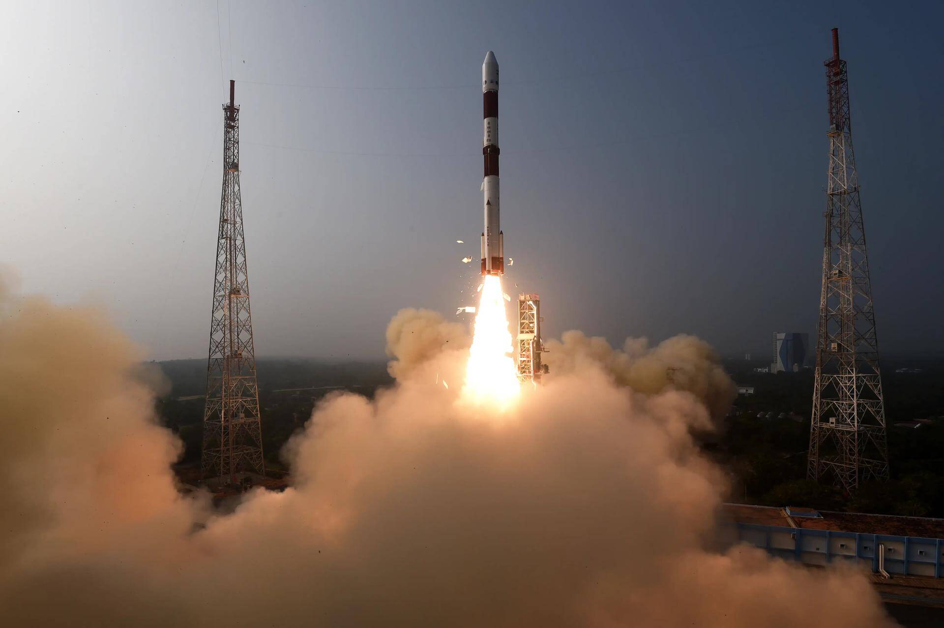
PSLV-DL | XPoSat
Indian Space Research Organization | IndiaSatish Dhawan Space Centre, India
Jan. 1, 2024, 3:40 a.m.
Status: Launch Successful
Mission:
XPoSat (X-ray Polarimeter Satellite) is India’s first dedicated polarimetry mission to study various dynamics of bright astronomical X-ray sources in extreme conditions. The spacecraft will carry two scientific payloads in a low earth orbit. The primary payload POLIX (Polarimeter Instrument in X-rays) will measure the polarimetry parameters (degree and angle of polarization) in medium X-ray energy range of 8-30 keV photons of astronomical origin. The XSPECT (X-ray Spectroscopy and Timing) payload will give spectroscopic information in the energy range of 0.8-15 keV. In addition, 10 attached payloads on the PSLV 4th stage will perform various experiments and testing from Indian institutions coordinated by ISRO, known as PSLV Orbital Experimental Module-3 (POEM-3).
Low Earth Orbit
