PSLV-XL
ActiveIndian Space Research Organization (ISRO)
Oct. 22, 2008
Description
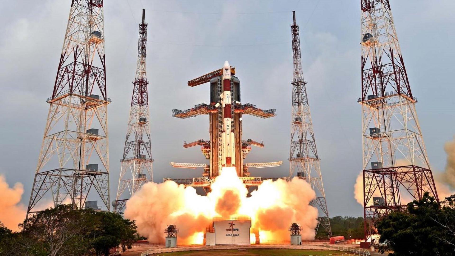
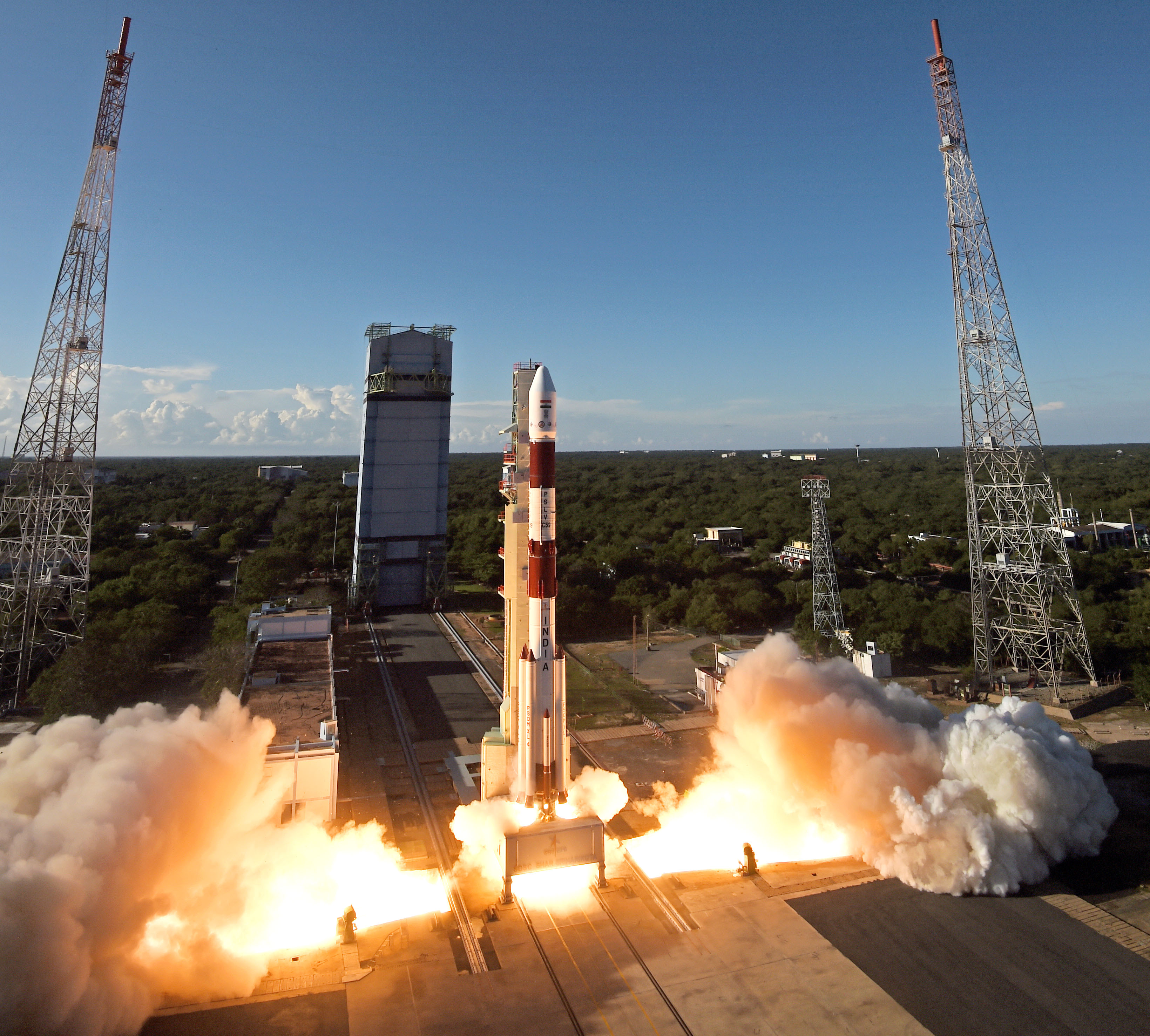
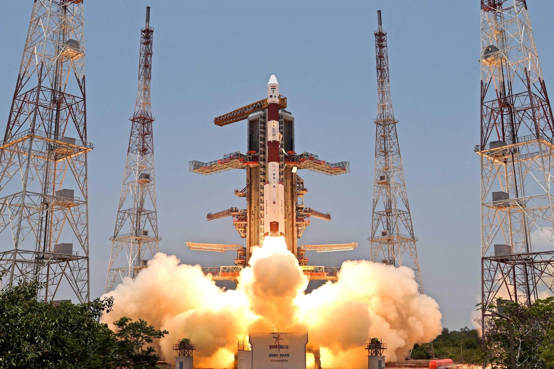
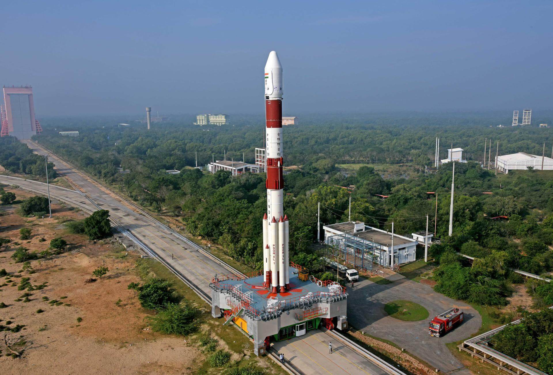
PSLV-XL is the upgraded version of Polar Satellite Launch Vehicle in its standard configuration boosted by more powerful, stretched strap-on boosters with 12 tonne propellant load. Weighing 320t at lift-off, the vehicle uses larger strap-on motors (PSOM-XL or S12) to achieve higher payload capability. On 29 December 2005, ISRO successfully tested the improved version of strap-on booster for the PSLV. The first use of PSLV-XL was the launch of Chandrayaan-1 by PSLV C11. The payload capability for this variant is 1,800 kg to SSO.
Specifications
-
Stages
4 -
Length
44.0 m -
Diameter
2.8 m -
Fairing Diameter
― -
Launch Mass
320.0 T -
Thrust
―
Family
-
Name
PSLV-XL -
Family
― -
Variant
XL -
Alias
― -
Full Name
PSLV XL
Payload Capacity
-
Launch Cost
― -
Low Earth Orbit
― -
Geostationary Transfer
Orbit
― -
Direct Geostationary
― -
Sun-Synchronous Capacity
1800.0 kg
Indian Space Research Organization
Government
Chairman: V. Narayanan
ISRO 1969The Indian Space Research Organisation (ISRO) is the space agency of the Government of India headquartered in the city of Bangalore. Its vision is to "harness space technology for national development while pursuing space science research and planetary exploration."
Upcoming Spaceflights
PSLV-XL | EOS-10 (Oceansat-3A)
Indian Space Research Organization | IndiaSatish Dhawan Space Centre, India
TBD March, 2026
PSLV-XL | EOS-09 (RISAT-1B)
Indian Space Research Organization | IndiaSatish Dhawan Space Centre, India
May 18, 2025, 12:29 a.m.
Status: Launch Failure
Mission:
RISAT-1B is the third in the series of radar imaging RISAT-1 satellites of ISRO using an active C-band SAR (Synthetic Aperture Radar), providing all-weather as well as the day-and-night SAR observation capability in applications such as agriculture, forestry, soil moisture, geology, sea ice, coastal monitoring, object identification, and flood monitoring, in addition to military surveillance. The RISAT-1 series is developed, manufactured and integrated by ISRO. The 3-axis stabilized spacecraft bus consists of a hexagonal prism shape build around a central cylinder. Most of the spacecraft subsystems and the payload are integrated in the prism structure and the central cylinder. The solar panels and some subsystems are mounted on the cube-shaped section of the spacecraft.
Sun-Synchronous OrbitPSLV-XL | Proba-3
Indian Space Research Organization | IndiaSatish Dhawan Space Centre, India
Dec. 5, 2024, 10:34 a.m.
Status: Launch Successful
Mission:
Proba-3 (Project for On-Board Autonomy 3) is the first close formation flying mission for the European Space Agency (ESA). It consists of two independent, three-axis stabilised spacecraft flying 150 meters from one another with the ability to accurately control the attitude and separation of the two craft. Such formation flying will be maintained for 6 hours, creating ″artificial solar eclipse″ for the satellite below. The spacecraft pair will fly a highly elliptical orbit divided between periods of accurate formation flying around apogee, when payload operations will be possible, and periods of free flight.
Elliptical OrbitPSLV-XL | Aditya-L1
Indian Space Research Organization | IndiaSatish Dhawan Space Centre, India
Sept. 2, 2023, 6:20 a.m.
Status: Launch Successful
Mission:
Aditya L1 is an Indian solar observation satellite to be placed at the Sun-Earth Lagrangian point L1. The major scientific objectives of the mission are to achieve a fundamental understanding of the physical processes that heat the solar corona, accelerate the solar wind and produce Coronal Mass Ejections (CMEs). Originally the mission design started as a small LEO satellite carrying only a coronagraph as a payload. In order to get the best science from the Sun, continuous viewing of the Sun is preferred. A Satellite placed in the halo orbit around the L1 Lagrangian point of the Sun-Earth system has the major advantage of continuously viewing the Sun without any occultation/ eclipses.
Heliocentric L1PSLV-XL | EOS-6 (Oceansat-3) & rideshare
Indian Space Research Organization | IndiaSatish Dhawan Space Centre, India
Nov. 26, 2022, 6:26 a.m.
PSLV-XL | EOS-4 (RISAT-1A)
Indian Space Research Organization | IndiaSatish Dhawan Space Centre, India
Feb. 14, 2022, 12:29 a.m.
PSLV-XL | CMS-01 (GSAT-12R)
Indian Space Research Organization | IndiaSatish Dhawan Space Centre, India
Dec. 17, 2020, 10:11 a.m.
Status: Launch Successful
Mission:
CMS-01, formerly also known as GSAT-12R, is an Indian geostationary telecommunications satellite. It's designed to last for 7 years and will provide services in Extended-C band across Indian mainland, Andaman-Nicobar & Lakshadweep Islands.
Geostationary Transfer OrbitPSLV-XL | Cartosat-3 & others
Indian Space Research Organization | IndiaSatish Dhawan Space Centre, India
Nov. 27, 2019, 3:58 a.m.
Status: Launch Successful
Mission:
Cartosat-3 is an advanced remote sensing satellite with high resolution imaging capability developed by ISRO. It's designed as a follow-on to the Cartosat-2 series. Many new technologies/elements were developed for it like highly agile structural platform, payload platform, higher rate data handling and transmission systems, advanced onboard computer and new power electronics, dual gimbal antenna, etc. This mission also carries 13 rideshare payloads, including 12 SuperDove cubesats and a technology demonstration Meshbed cubesat.
Sun-Synchronous OrbitPSLV XL | IRNSS-1I
Indian Space Research Organization | IndiaSatish Dhawan Space Centre, India
April 11, 2018, 10:34 p.m.
Status: Launch Successful
Mission:
This is a replacement satellite for the IRNSS-1H of the Indian Regional Navigation Satellite System. The constellation will provide India with an alternative to GPS and will be used for military and civilian use. Located at a geosynchronous orbit, the system will be operated by the Indian government.
Geosynchronous Transfer OrbitPSLV XL | Cartosat-2F (Cartosat-2S4)
Indian Space Research Organization | IndiaSatish Dhawan Space Centre, India
Jan. 12, 2018, 3:59 a.m.
Status: Launch Successful
Mission:
Cartosat-2F is eighth of Cartosat series of Earth observation satellites to be deployed in a sun-synchronous orbit. Its main purpose is to collect high resolution large-scale maps which will be used for urban planning, infrastructure development, utilities planning and traffic management.
Sun-Synchronous OrbitPSLV XL | IRNSS-1H
Indian Space Research Organization | IndiaSatish Dhawan Space Centre, India
Aug. 31, 2017, 1:30 p.m.
Status: Launch Failure
Mission:
This is a replacement satellite for the IRNSS-1A of the Indian Regional Navigation Satellite System. The constellation will provide India with an alternative to GPS and will be used for military and civilian use. Located at a geosynchronous orbit the system will be operated by the Indian government.
Geosynchronous Transfer OrbitPSLV XL | Cartosat-2E
Indian Space Research Organization | IndiaSatish Dhawan Space Centre, India
June 23, 2017, 3:59 a.m.
Status: Launch Successful
Mission:
Cartosat-2E is seventh of Cartosat series of Earth observation satellites to be deployed in 500 km sun-synchronous orbit. Its main purpose is to collect high resolution large-scale maps which will be used for urban planning, infrastructure development, utilities planning and traffic management.
Sun-Synchronous OrbitPSLV XL | Cartosat-2D & 103 others
Indian Space Research Organization | IndiaSatish Dhawan Space Centre, India
Feb. 15, 2017, 3:58 a.m.
Status: Launch Successful
Mission:
Cartosat 2D is a remote sensing satellite for ISRO and is tasked with land observation from sun-synchronous orbit. It is launched along with 103 small satellites of foreign companies and research groups. Among these, 88 cubesats are Earth-imaging Dove satellites operated by Planet Labs company.
Sun-Synchronous OrbitPSLV XL | Resourcesat-2A
Indian Space Research Organization | IndiaSatish Dhawan Space Centre, India
Dec. 7, 2016, 4:54 a.m.
PSLV XL | Cartosat-2C & 19 small satellites
Indian Space Research Organization | IndiaSatish Dhawan Space Centre, India
June 22, 2016, 3:55 a.m.
Status: Launch Successful
Mission:
Cartosat 2C is a remote sensing satellite. The satellite was built, launched and is maintained by the Indian Space Research Organisation. 18 satellites were also launched for foreign agencies including those from the U.S., Canada, Germany, and Indonesia.
Sun-Synchronous OrbitPSLV XL | IRNSS-1G
Indian Space Research Organization | IndiaSatish Dhawan Space Centre, India
April 28, 2016, 7:20 a.m.
Status: Launch Successful
Mission:
This is the 7th and final satellite for the Indian Regional Navigation Satellite System. The constellation will provide India with an alternative to GPS and will be used for military and civilian use. Located at a geosynchronous orbit the system will be operated by the Indian government.
Geostationary Transfer OrbitPSLV XL | IRNSS-1F
Indian Space Research Organization | IndiaSatish Dhawan Space Centre, India
March 10, 2016, 10:31 a.m.
Status: Launch Successful
Mission:
This is the 6th satellite out of 7 for the Indian Regional Navigation Satellite System. The constellation will provide India with an alternative to GPS and will be used for military and civilian use. Located at a geosynchronous orbit the system will be operated by the Indian government.
Geostationary Transfer OrbitPSLV XL | IRNSS-1E
Indian Space Research Organization | IndiaSatish Dhawan Space Centre, India
Jan. 20, 2016, 4:01 a.m.
Status: Launch Successful
Mission:
This is the 5th satellite out of 7 for the Indian Regional Navigation Satellite System. The constellation will provide India with an alternative to GPS and will be used for military and civilian use. Located at a geosynchronous orbit the system will be operated by the Indian government.
Geosynchronous Transfer OrbitPSLV XL | Astrosat
Indian Space Research Organization | IndiaSatish Dhawan Space Centre, India
Sept. 28, 2015, 4:30 a.m.
PSLV XL | DMC-3A, DMC-3B, DMC-3C, CBNT-1 & DeOrbitSAIL
Indian Space Research Organization | IndiaSatish Dhawan Space Centre, India
July 10, 2015, 4:28 p.m.
Status: Launch Successful
Mission:
The Polar Satellite Launch Vehicle (PSLV), in its thirtieth flight (PSLV-C28), will launch three identical DMC3 optical earth observation satellites. A, B and C. It will also carry two auxiliary satellites from UK. CBNT-1, a technology demonstrator earth observation micro satellite, and De-OrbitSail, a technology demonstrator nano satellite.
Low Earth OrbitPSLV XL | IRNSS-1D
Indian Space Research Organization | IndiaSatish Dhawan Space Centre, India
March 28, 2015, 11:49 a.m.
PSLV XL | IRNSS-1C
Indian Space Research Organization | IndiaSatish Dhawan Space Centre, India
Oct. 15, 2014, 8:02 p.m.
PSLV XL | IRNSS-1B
Indian Space Research Organization | IndiaSatish Dhawan Space Centre, India
April 4, 2014, 11:44 a.m.
Status: Launch Successful
Mission:
IRNSS-1B is the second out of seven in the Indian Regional Navigational Satellite System (IRNSS) series of satellites after IRNSS-1A. The satellite is one among the seven of the IRNSS constellation of satellites slated to provide navigational services to the region. The satellite operates in geosynchronous orbit.
Geosynchronous Transfer OrbitPSLV XL | Mars Orbiter Mission (MOM)
Indian Space Research Organization | IndiaSatish Dhawan Space Centre, India
Nov. 5, 2013, 9:08 a.m.
PSLV XL | IRNSS-1A
Indian Space Research Organization | IndiaSatish Dhawan Space Centre, India
July 1, 2013, 6:11 p.m.
PSLV XL | RISAT-1
Indian Space Research Organization | IndiaSatish Dhawan Space Centre, India
April 26, 2012, 12:17 a.m.
PSLV XL | GSAT-12
Indian Space Research Organization | IndiaSatish Dhawan Space Centre, India
July 15, 2011, 11:18 a.m.
Falcon 9
Starlink Group 6-104
Space Launch Complex 40 - Cape Canaveral SFS, FL, USAA batch of 28 satellites for the Starlink mega-constellation - SpaceX's project for space-based Internet communication system.
Falcon 9
Starlink Group 17-25
Space Launch Complex 4E - Vandenberg SFB, CA, USAA batch of 25 satellites for the Starlink mega-constellation - SpaceX's project for space-based Internet communication system.
Falcon 9
Starlink Group 10-36
Space Launch Complex 40 - Cape Canaveral SFS, FL, USAA batch of 29 satellites for the Starlink mega-constellation - SpaceX's project for space-based Internet communication system. First Starlink laun…
Falcon 9
Starlink Group 6-103
Space Launch Complex 40 - Cape Canaveral SFS, FL, USAA batch of 29 satellites for the Starlink mega-constellation - SpaceX's project for space-based Internet communication system.
Falcon 9
Starlink Group 17-13
Space Launch Complex 4E - Vandenberg SFB, CA, USAA batch of 24 satellites for the Starlink mega-constellation - SpaceX's project for space-based Internet communication system.


