GSLV Mk II
ActiveIndian Space Research Organization (ISRO)
April 15, 2010
Description
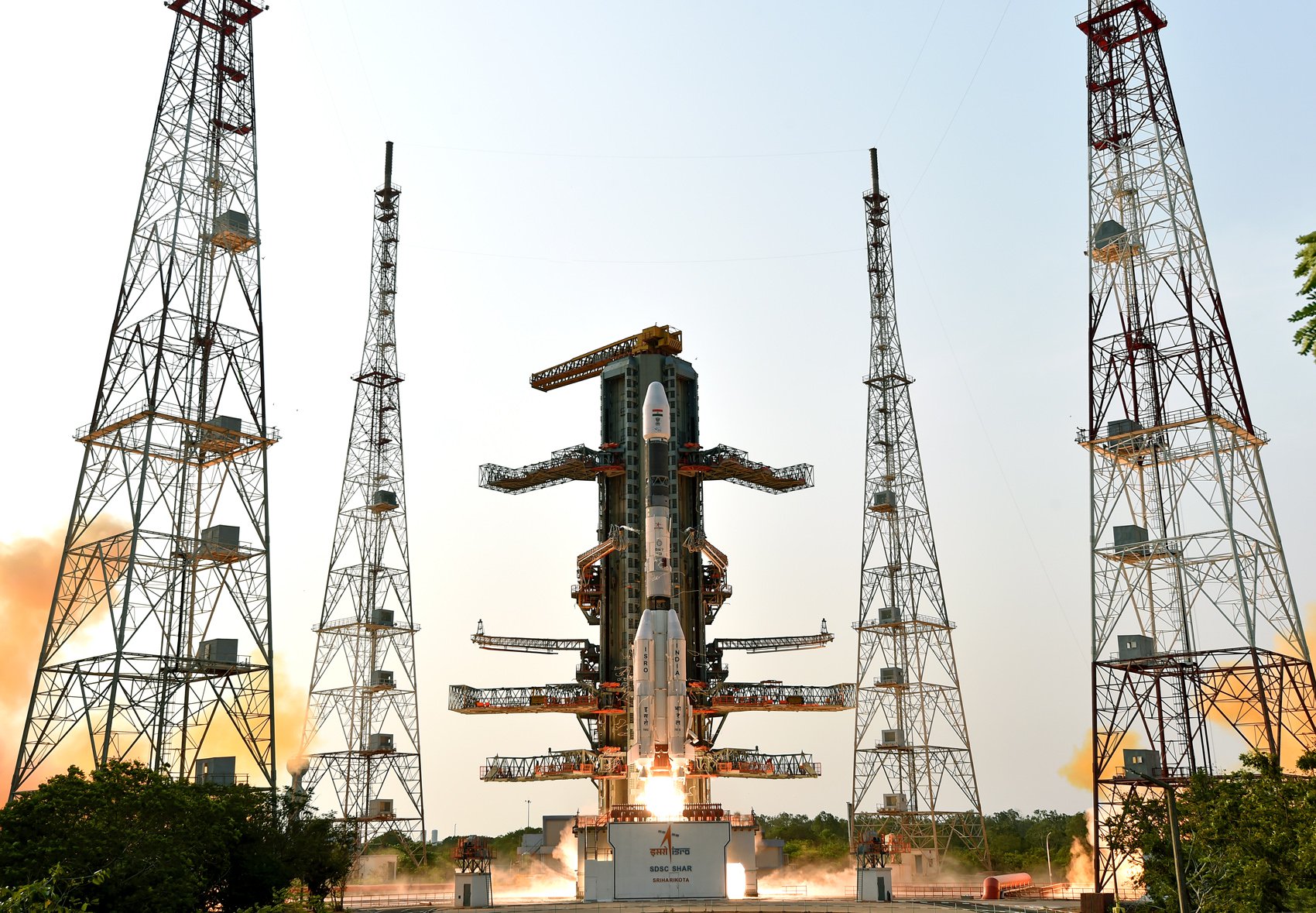
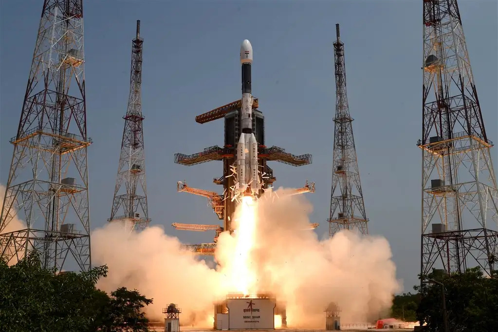
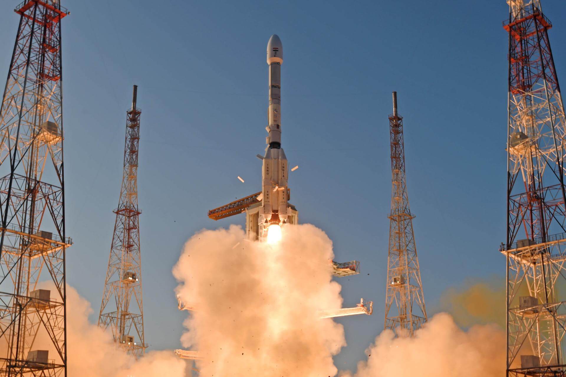
Geosynchronous Satellite Launch Vehicle Mark II (GSLV Mk II) is the largest launch vehicle developed by India, which is currently in operation. This fourth generation launch vehicle is a three stage vehicle with four liquid strap-ons. The indigenously developed cryogenic Upper Stage (CUS), which is flight proven, forms the third stage of GSLV Mk II. From January 2014, the vehicle has achieved four consecutive successes.
Specifications
-
Max Stage
3 -
Length
49.0 m -
Diameter
2.8 m -
Fairing Diameter
― -
Launch Mass
401.0 T -
Thrust
7420.0 kN -
Apogee (Sub-Orbital)
40000.0 km
Family
-
Name
GSLV Mk II -
Family
― -
Variant
― -
Alias
― -
Full Name
GSLV Mk. II
Payload Capacity
-
Launch Cost
― -
Low Earth Orbit
― -
Geostationary Transfer
Orbit
2500.0 kg -
Direct Geostationary
― -
Sun-Synchronous Capacity
―
Indian Space Research Organization
Government
Chairman: V. Narayanan
ISRO 1969The Indian Space Research Organisation (ISRO) is the space agency of the Government of India headquartered in the city of Bangalore. Its vision is to "harness space technology for national development while pursuing space science research and planetary exploration."
Upcoming Spaceflights
GSLV Mk II | GISAT-1A (EOS-05)
Indian Space Research Organization | IndiaSatish Dhawan Space Centre, India
TBD March, 2026
GSLV Mk II | GSAT-32
Indian Space Research Organization | IndiaSatish Dhawan Space Centre, India
TBD March, 2026
GSLV Mk II | IRNSS-1L (NVS-03)
Indian Space Research Organization | IndiaSatish Dhawan Space Centre, India
TBD December, 2026
Status: To Be Determined
Mission:
This is a replacement satellite for the Indian Regional Navigation Satellite System. The constellation will provide India with an alternative to GPS and will be used for military and civilian use. Located at a geosynchronous orbit, the system will be operated by the Indian government.
Geostationary Transfer OrbitGSLV | IDRSS-2
Indian Space Research Organization | IndiaSatish Dhawan Space Centre, India
TBD December, 2026
GSLV | IDRSS-1
Indian Space Research Organization | IndiaSatish Dhawan Space Centre, India
TBD December, 2026
GSLV Mk II | NISAR (NASA-ISRO Synthetic Aperture Radar)
Indian Space Research Organization | IndiaSatish Dhawan Space Centre, India
July 30, 2025, 12:10 p.m.
Status: Launch Successful
Mission:
The NASA-ISRO Synthetic Aperture Radar, or NISAR satellite, will use advanced radar imaging to map the elevation of Earth's land and ice masses 4 to 6 times a month at resolutions of 5 to 10 meters. It is designed to observe and measure some of the planet's most complex natural processes, including ecosystem disturbances, ice-sheet collapse, and natural hazards such as earthquakes, tsunamis, volcanoes and landslides. Under the terms of the agreement, NASA will provide the mission's L band synthetic aperture radar (SAR), a high-rate telecommunication subsystem for scientific data, GPS receivers, a solid-state recorder, and a payload data subsystem. ISRO will provide the satellite bus, an S band synthetic aperture radar, the launch vehicle, and associated launch services.
Sun-Synchronous OrbitGSLV Mk II | IRNSS-1K (NVS-02)
Indian Space Research Organization | IndiaSatish Dhawan Space Centre, India
Jan. 29, 2025, 12:53 a.m.
Status: Launch Successful
Mission:
This is a replacement satellite for the Indian Regional Navigation Satellite System. The constellation will provide India with an alternative to GPS and will be used for military and civilian use. Located at a geosynchronous orbit, the system will be operated by the Indian government.
Geostationary Transfer OrbitGSLV Mk II | INSAT-3DS
Indian Space Research Organization | IndiaSatish Dhawan Space Centre, India
Feb. 17, 2024, 12:05 p.m.
Status: Launch Successful
Mission:
INSAT-3DS is an Indian weather satellite built by the Indian Space Research Organisation and operated by ISRO as part of the Indian National Satellite System. It provides meteorological services to India using a 6-channel imager and a 19-channel sounder, as well as search and rescue information and message relay for terrestrial data collection platforms. The satellite will be a follow-up to INSAT-3DR.
Geostationary Transfer OrbitGSLV Mk II | IRNSS-1J (NVS-01)
Indian Space Research Organization | IndiaSatish Dhawan Space Centre, India
May 29, 2023, 5:12 a.m.
Status: Launch Successful
Mission:
This is a replacement satellite for the Indian Regional Navigation Satellite System. The constellation will provide India with an alternative to GPS and will be used for military and civilian use. Located at a geosynchronous orbit, the system will be operated by the Indian government.
Geostationary Transfer OrbitGSLV Mk II | EOS-03 (GISAT-1)
Indian Space Research Organization | IndiaSatish Dhawan Space Centre, India
Aug. 12, 2021, 12:13 a.m.
Status: Launch Failure
Mission:
GISAT-1 is an Indian earth observation satellite to be launched in geostationary orbit. It is tasked with continuous observation of Indian sub-continent and quick monitoring of natural hazards and disaster. GISAT carries an imaging payload consisting of of multi-spectral, multi-resolution from 50 m to 1.5 km. It will provide pictures of the area of interest on near real time basis including border areas.
Geostationary Transfer OrbitGSLV Mk II | GSAT-7A
Indian Space Research Organization | IndiaSatish Dhawan Space Centre, India
Dec. 19, 2018, 10:40 a.m.
GSLV Mk II | GSAT-6A
Indian Space Research Organization | IndiaSatish Dhawan Space Centre, India
March 29, 2018, 11:26 a.m.
GSLV Mk II | SouthAsiaSat (GSAT-9)
Indian Space Research Organization | IndiaSatish Dhawan Space Centre, India
May 5, 2017, 11:27 a.m.
Status: Launch Successful
Mission:
GSAT-9 is a multi band communication and observation satellite. It carries a GAGAN (regional Indian GPS navigational system) navigation payload to provide GPS services to security forces and air traffic control organizations. Weighing about 2330 kg, satellite has an operational lifetime of 12 years.
Geostationary Transfer OrbitGSLV Mk II | INSAT-3DR
Indian Space Research Organization | IndiaSatish Dhawan Space Centre, India
Sept. 8, 2016, 11:20 a.m.
Status: Launch Successful
Mission:
INSAT-3DR is an advanced weather satellite designed for enhanced meteorological observations and will replace INSAT-3D. This involves monitoring land and ocean surfaces, as well as the atmosphere, to provide weather forecasting and disaster warnings. The satellite weighs 2061kg and will operate in a geo-synchronous orbit for its 7 year lifespan.
Geostationary Transfer OrbitGSLV Mk II | GSAT-6
Indian Space Research Organization | IndiaSatish Dhawan Space Centre, India
Aug. 27, 2015, 11:22 a.m.
GSLV Mk II | GSAT-14
Indian Space Research Organization | IndiaSatish Dhawan Space Centre, India
Jan. 5, 2014, 10:48 a.m.
Falcon 9
Starlink Group 17-26
Space Launch Complex 4E - Vandenberg SFB, CA, USAA batch of 25 satellites for the Starlink mega-constellation - SpaceX's project for space-based Internet communication system.
Falcon 9
Starlink Group 6-110
Space Launch Complex 40 - Cape Canaveral SFS, FL, USAA batch of 29 satellites for the Starlink mega-constellation - SpaceX's project for space-based Internet communication system.
Falcon 9
Starlink Group 6-104
Space Launch Complex 40 - Cape Canaveral SFS, FL, USAA batch of 28 satellites for the Starlink mega-constellation - SpaceX's project for space-based Internet communication system.
Falcon 9
Starlink Group 17-25
Space Launch Complex 4E - Vandenberg SFB, CA, USAA batch of 25 satellites for the Starlink mega-constellation - SpaceX's project for space-based Internet communication system.
Falcon 9
Starlink Group 10-36
Space Launch Complex 40 - Cape Canaveral SFS, FL, USAA batch of 29 satellites for the Starlink mega-constellation - SpaceX's project for space-based Internet communication system. First Starlink laun…


