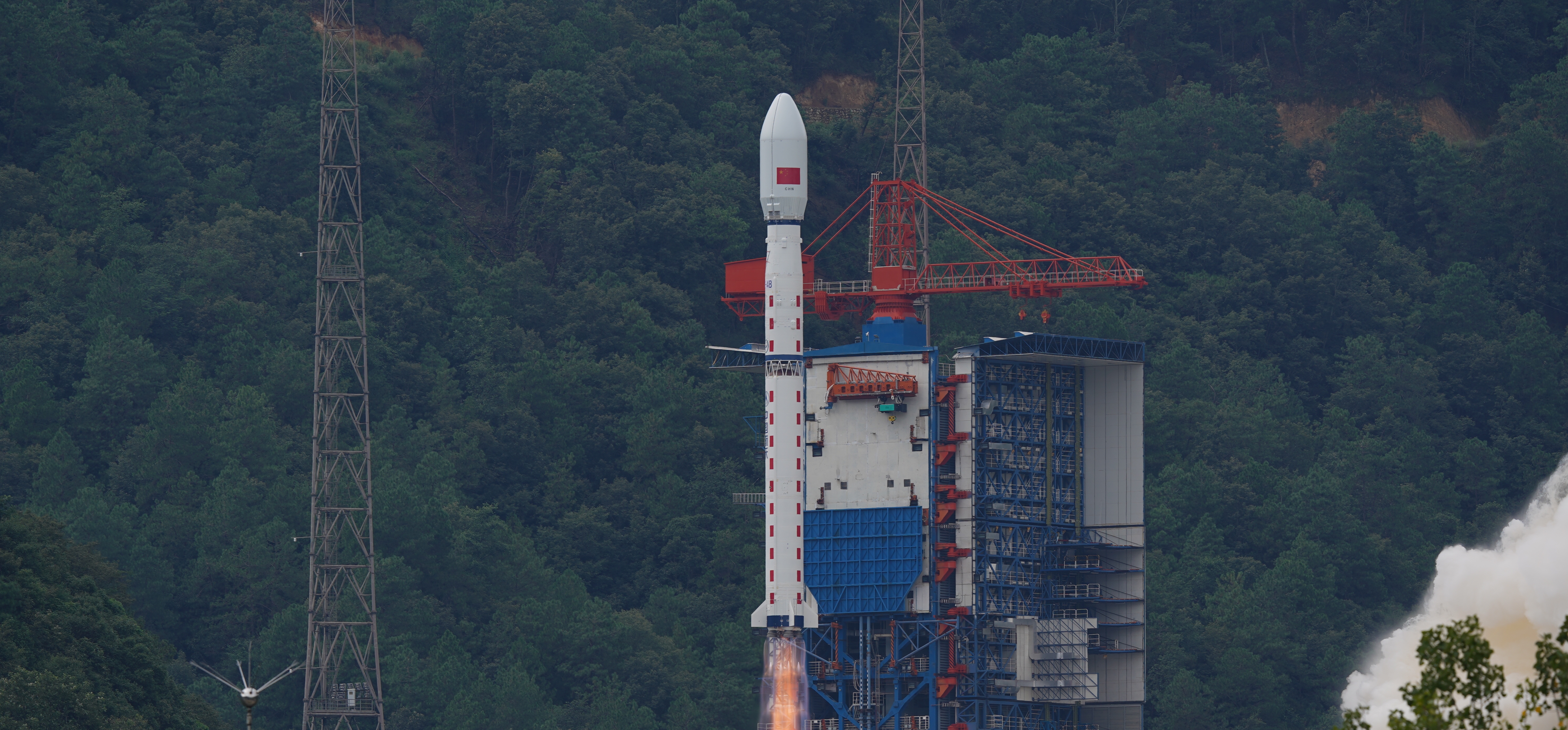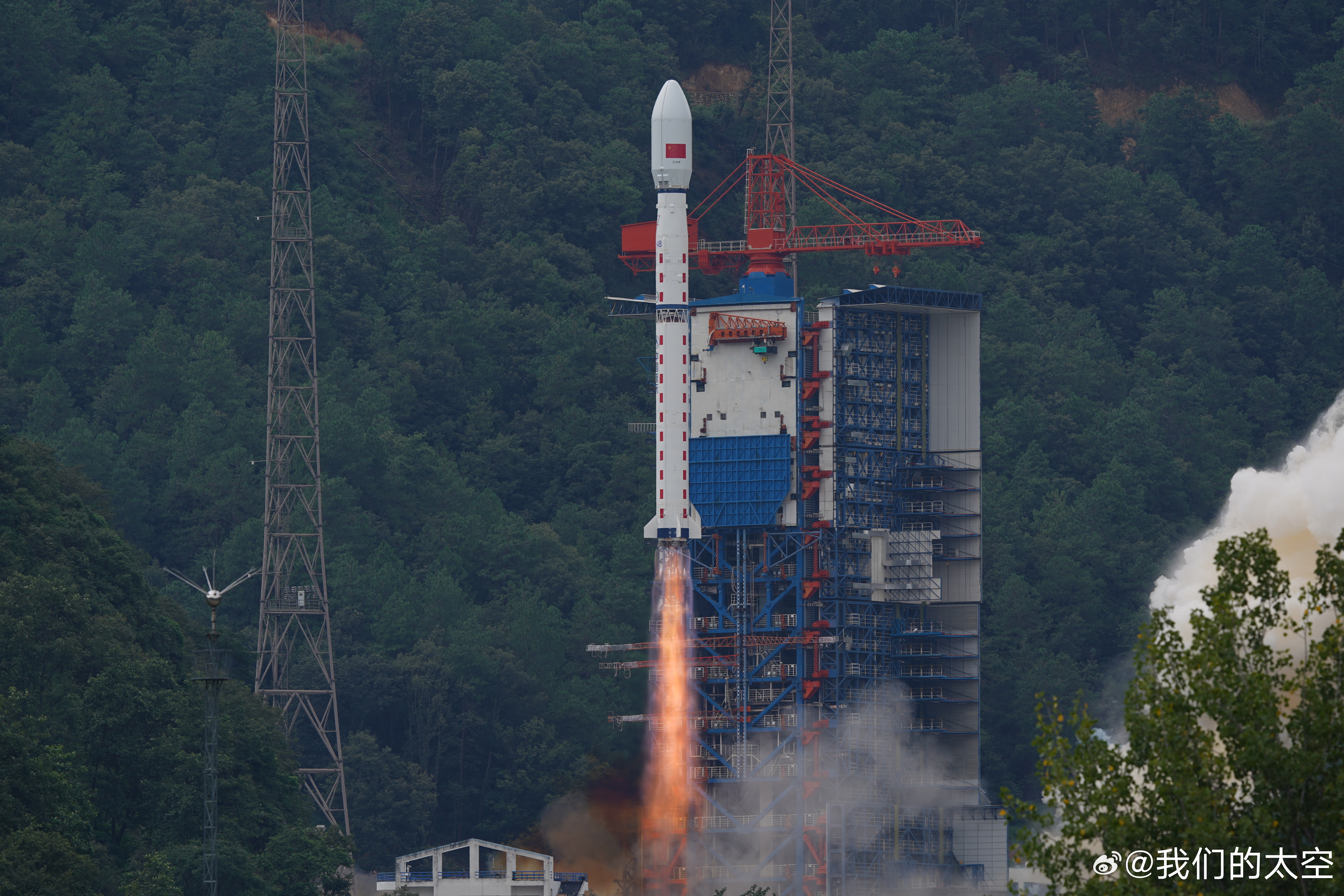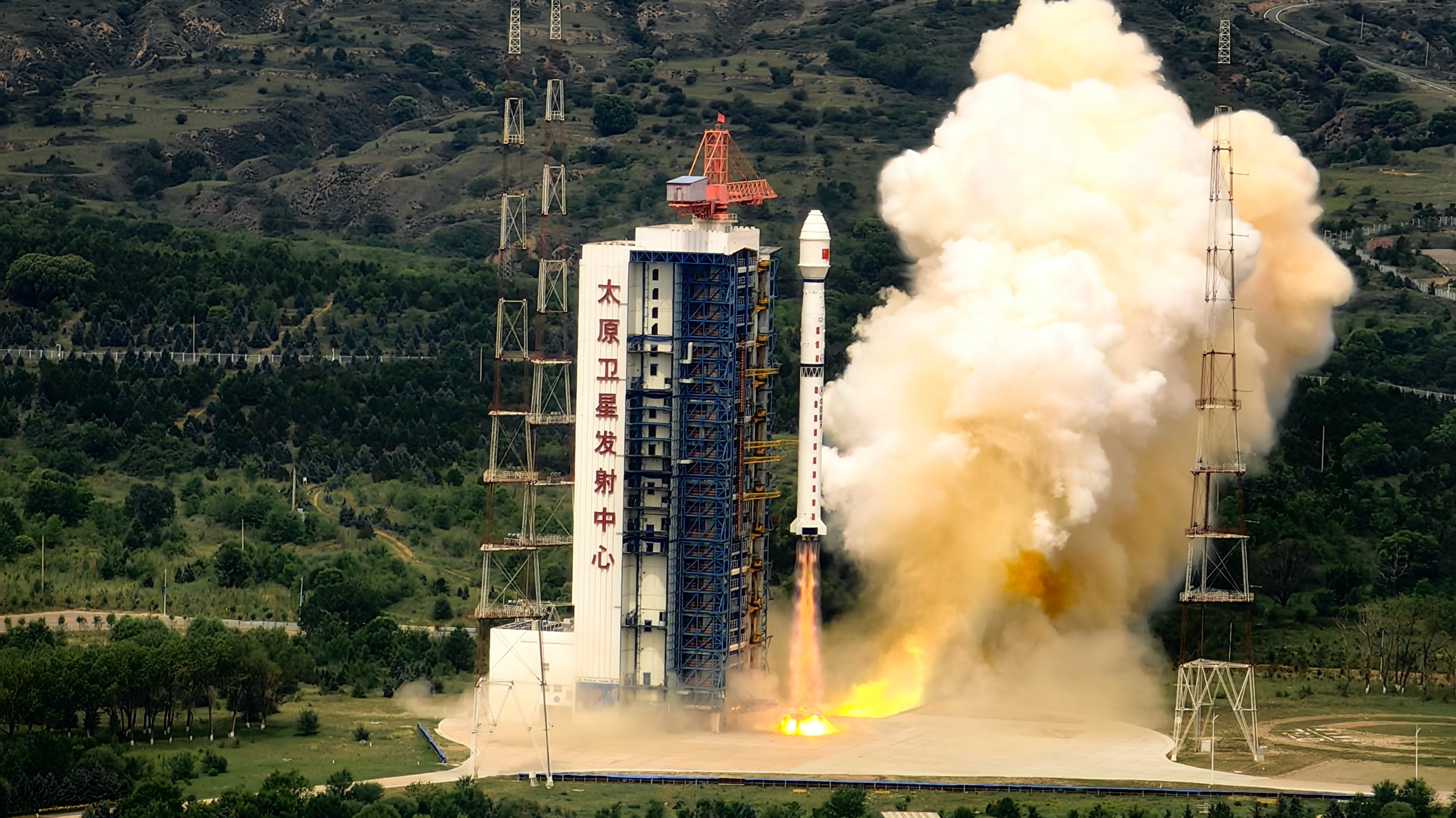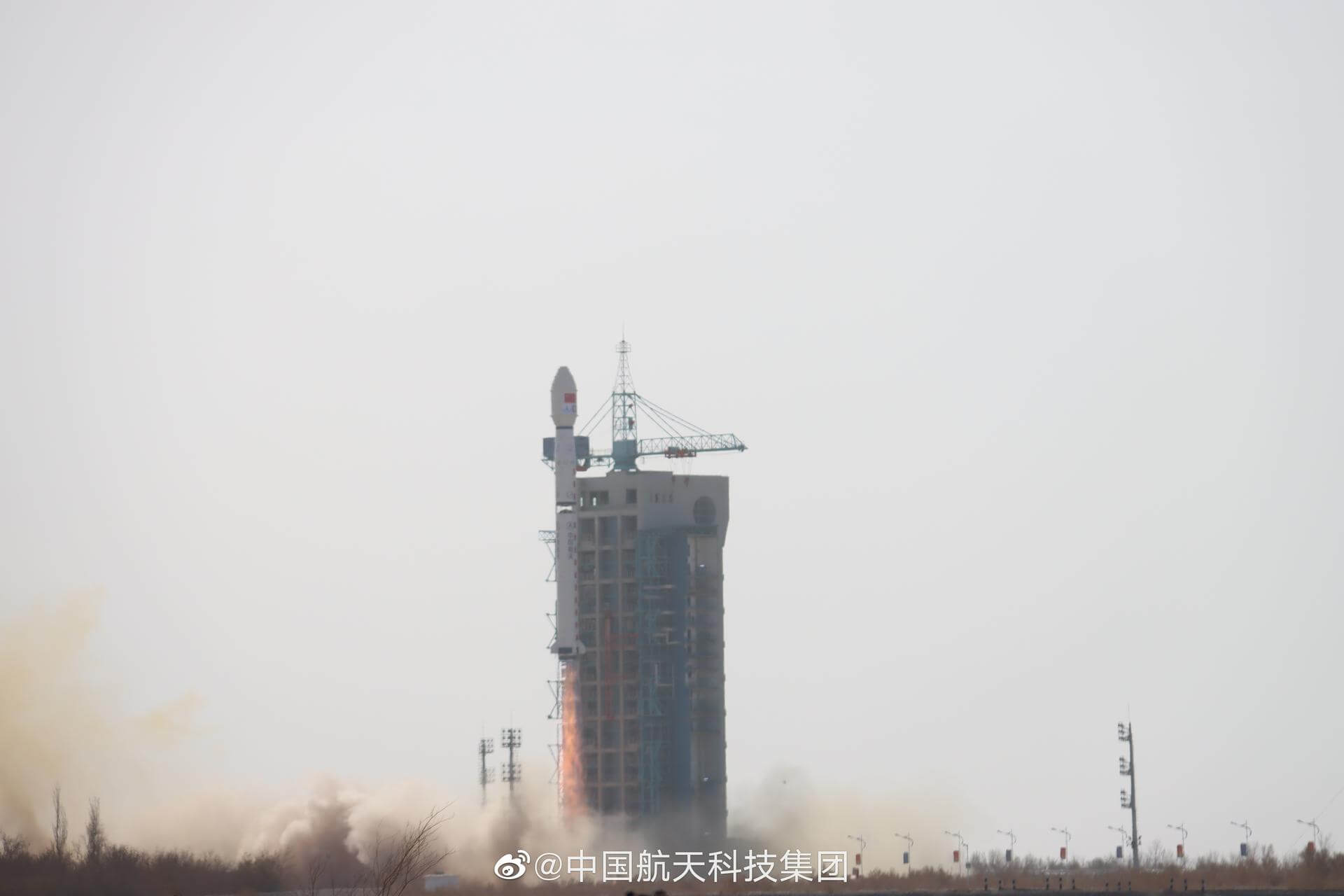
Long March 4B
ActiveChina Aerospace Science and Technology Corporation (CASC)
May 10, 1999
Description
The Long March 4B (Chinese: 长征四号乙火箭), also known as the Chang Zheng 4B, CZ-4B and LM-4B is a Chinese orbital carrier rocket. Launched from Launch Complex 1 at the Taiyuan Satellite Launch Center, it is a 3-stage rocket, used mostly to place satellites into low Earth and sun synchronous orbits.
Specifications
-
Stages
3 -
Length
44.1 m -
Diameter
3.35 m -
Fairing Diameter
― -
Launch Mass
249.0 T -
Thrust
2961.0 kN
Family
-
Name
Long March 4B -
Family
― -
Variant
B -
Alias
― -
Full Name
Long March 4B
Payload Capacity
-
Launch Cost
― -
Low Earth Orbit
4200.0 kg -
Geostationary Transfer
Orbit
1500.0 kg -
Direct Geostationary
― -
Sun-Synchronous Capacity
―
China Aerospace Science and Technology Corporation
Government
Chairman & President: Lei Fanpei
CASC 1999The China Aerospace Science and Technology Corporation (CASC) is the main contractor for the Chinese space program. It is state-owned and has a number of subordinate entities which design, develop and manufacture a range of spacecraft, launch vehicles, strategic and tactical missile systems, and ground equipment. It was officially established in July 1999 as part of a Chinese government reform drive, having previously been one part of the former China Aerospace Corporation. Various incarnations of the program date back to 1956.
Long March 4B | Tianhui 7
China Aerospace Science and Technology Corporation | ChinaJiuquan Satellite Launch Center, People's Republic of China
Dec. 30, 2025, 4:12 a.m.
Long March 4B | Ziyuan-3-04
China Aerospace Science and Technology Corporation | ChinaTaiyuan Satellite Launch Center, People's Republic of China
Dec. 16, 2025, 3:17 a.m.
Status: Launch Successful
Mission:
The ZY-3 (Ziyuan-3, 'Resource-3') series represents China's first high-resolution, stereoscopic mapping satellites for civilian use. The second satellite is managed by the Satellite Surveying and Mapping Application Center (SASMAC). The imaging payload consists of a three-line camera array and a multispectral imager. The three-line panchromatic camera array to acquire stereoscopic imagery consists of three telescopic cameras with one oriented to the nadir and the other two each offset by 22° forward and backward in flight direction. The stereo mapping camera of ZY-3 has a resolution of 2.1 m for the nadir camera, and 2.6 m for the offset cameras. The swath width is 51 km. The multispectral imager for environmental and vegetation monitoring consists of a three-mirror telescope and a cooled detector system sensitive to four wavelength bands to capture full-color imagery as well as near-infrared data. The ground resolution of this system is 5.8 m.
Sun-Synchronous OrbitLong March 4B | Yaogan 47
China Aerospace Science and Technology Corporation | ChinaJiuquan Satellite Launch Center, People's Republic of China
Dec. 9, 2025, 3:41 a.m.
Long March 4B | Shijian 26
China Aerospace Science and Technology Corporation | ChinaJiuquan Satellite Launch Center, People's Republic of China
May 29, 2025, 4:12 a.m.
Long March 4B | Haiyang 4-01
China Aerospace Science and Technology Corporation | ChinaTaiyuan Satellite Launch Center, People's Republic of China
Nov. 13, 2024, 10:42 p.m.
Long March 4B | Yaogan 43 Group 02
China Aerospace Science and Technology Corporation | ChinaXichang Satellite Launch Center, People's Republic of China
Sept. 3, 2024, 1:22 a.m.
Long March 4B | Yaogan 43 Group 01
China Aerospace Science and Technology Corporation | ChinaXichang Satellite Launch Center, People's Republic of China
Aug. 16, 2024, 7:35 a.m.
Long March 4B | Gaofen-11-05
China Aerospace Science and Technology Corporation | ChinaTaiyuan Satellite Launch Center, People's Republic of China
July 19, 2024, 3:03 a.m.
Status: Launch Successful
Mission:
Gaofen is a series of civilian Earth observation satellites developed and launched for the China High-definition Earth Observation System (CHEOS), a state-sponsored programme aimed to develop a near-real time, all-weather, global surveillance network consisting of satellite, near-space (stratosphere) airships, and aerial observation platforms.
Sun-Synchronous OrbitLong March 4B | Fengyun-3G
China Aerospace Science and Technology Corporation | ChinaJiuquan Satellite Launch Center, People's Republic of China
April 16, 2023, 1:36 a.m.
Long March 4B | Gaofen-11-04
China Aerospace Science and Technology Corporation | ChinaTaiyuan Satellite Launch Center, People's Republic of China
Dec. 27, 2022, 7:37 a.m.
Status: Launch Successful
Mission:
Gaofen is a series of civilian Earth observation satellites developed and launched for the China High-definition Earth Observation System (CHEOS), a state-sponsored programme aimed to develop a near-real time, all-weather, global surveillance network consisting of satellite, near-space (stratosphere) airships, and aerial observation platforms.
Sun-Synchronous OrbitLong March 4B | Terrestrial Ecosystem Carbon Inventory Satellite (TECIS)
China Aerospace Science and Technology Corporation | ChinaTaiyuan Satellite Launch Center, People's Republic of China
Aug. 4, 2022, 3:08 a.m.
Status: Launch Successful
Mission:
Note: Launch vehicle and payload uncertain. The Terrestrial Ecosystem Carbon Monitoring Satellite (TECIS) is intended to evaluate forest biomass, measure atmospheric aerosol content, and detect photosynthetic fluorescence. These measurements will contribute to efforts to combat global warming. The satellite carries 4 instruments: Multi-Beam LIDAR, Directional Multi-Spectral Camera, Directional Polarization Camera, and Chlorophyll Fluorescence Hyper-Spectral Monitor (SIFIS) The satellite will operate in a sun-synchronous orbit at a height of 506 km, at 10:30 AM local time in the descending mode, with a designed lifetime of 8 years.
Sun-Synchronous OrbitLong March 4B | Shijian 6 Group 05
China Aerospace Science and Technology Corporation | ChinaJiuquan Satellite Launch Center, People's Republic of China
Dec. 10, 2021, 12:11 a.m.
Status: Launch Successful
Mission:
The SJ 6 (Shi Jian 6) series consisted of pairs of technology satellites, which were reported to be used to probe the space environment, radiation and its effects, record space physical environment parameters, and conduct other related space experiments.
Sun-Synchronous OrbitLong March 4B | Gaofen-11-03
China Aerospace Science and Technology Corporation | ChinaTaiyuan Satellite Launch Center, People's Republic of China
Nov. 20, 2021, 1:51 a.m.
Status: Launch Successful
Mission:
Gaofen is a series of civilian Earth observation satellites developed and launched for the China High-definition Earth Observation System (CHEOS), a state-sponsored programme aimed to develop a near-real time, all-weather, global surveillance network consisting of satellite, near-space (stratosphere) airships, and aerial observation platforms.
Sun-Synchronous OrbitLong March 4B | Tianhui-2-02
China Aerospace Science and Technology Corporation | ChinaTaiyuan Satellite Launch Center, People's Republic of China
Aug. 18, 2021, 10:32 p.m.
Long March 4B | Haiyang 2D
China Aerospace Science and Technology Corporation | ChinaJiuquan Satellite Launch Center, People's Republic of China
May 19, 2021, 4:03 a.m.
Long March 4B | Shiyan-6-03
China Aerospace Science and Technology Corporation | ChinaTaiyuan Satellite Launch Center, People's Republic of China
April 8, 2021, 11:01 p.m.
Long March 4B | Huanjing 2A, 2B
China Aerospace Science and Technology Corporation | ChinaTaiyuan Satellite Launch Center, People's Republic of China
Sept. 27, 2020, 3:23 a.m.
Status: Launch Successful
Mission:
Huanjing (abbreviated as HJ) is a constellation of environmental monitoring satellites. The HJ-2A and HJ-2B are 16-meter optical satellites which will provide 16-meter multispectral, 48-meter hyperspectral and infrared image data.
Sun-Synchronous OrbitLong March 4B | Haiyang 2C
China Aerospace Science and Technology Corporation | ChinaJiuquan Satellite Launch Center, People's Republic of China
Sept. 21, 2020, 5:40 a.m.
Long March 4B | Gaofen-11-02
China Aerospace Science and Technology Corporation | ChinaTaiyuan Satellite Launch Center, People's Republic of China
Sept. 7, 2020, 5:57 a.m.
Status: Launch Successful
Mission:
Gaofen is a series of civilian Earth observation satellites developed and launched for the China High-definition Earth Observation System (CHEOS), a state-sponsored programme aimed to develop a near-real time, all-weather, global surveillance network consisting of satellite, near-space (stratosphere) airships, and aerial observation platforms.
Sun-Synchronous OrbitLong March 4B | Ziyuan-3-03
China Aerospace Science and Technology Corporation | ChinaTaiyuan Satellite Launch Center, People's Republic of China
July 25, 2020, 3:13 a.m.
Status: Launch Successful
Mission:
Ziyuan is a series of remote sensing satellites in Sun-synchronous orbit around Earth. Ziyuan 3-02 is a Chinese Earth observation satellite, a high-resolution imaging satellite operated by the Ministry of Land and Resources of the People's Republic of China.
Sun-Synchronous OrbitLong March 4B | Gaofen Multimode
China Aerospace Science and Technology Corporation | ChinaTaiyuan Satellite Launch Center, People's Republic of China
July 3, 2020, 3:10 a.m.
Status: Launch Successful
Mission:
Gaofen is a series of civilian Earth observation satellites developed and launched for the China High-definition Earth Observation System (CHEOS), a state-sponsored programme aimed to develop a near-real time, all-weather, global surveillance network consisting of satellite, near-space (stratosphere) airships, and aerial observation platforms.
Sun-Synchronous OrbitLong March 4B | CBERS-4A
China Aerospace Science and Technology Corporation | ChinaTaiyuan Satellite Launch Center, People's Republic of China
Dec. 20, 2019, 3:22 a.m.
Status: Launch Successful
Mission:
On April 24, 2015, China and Brazil have signed the agreement for the construction of CBERS-4A. It's a third satellite in the continuity to the CBERS program, and a sixth CBERS satellite to be constructed. The CBERS satellites enhance and complement the existing remote sensing systems in an effort to improve our knowledge about the Earth environment and resources.
Sun-Synchronous OrbitLong March 4B | Gaofen-7 & others
China Aerospace Science and Technology Corporation | ChinaTaiyuan Satellite Launch Center, People's Republic of China
Nov. 3, 2019, 3:22 a.m.
Status: Launch Successful
Mission:
Gaofen is a series of civilian Earth observation satellites developed and launched for the China High-definition Earth Observation System (CHEOS), a state-sponsored programme aimed to develop a near-real time, all-weather, global surveillance network consisting of satellite, near-space (stratosphere) airships, and aerial observation platforms.
Long March 4B | Ziyuan-2D, Tianyi MV-1, BNU-1
China Aerospace Science and Technology Corporation | ChinaTaiyuan Satellite Launch Center, People's Republic of China
Sept. 12, 2019, 3:26 a.m.
Long March 4B | Tianhui-2-01
China Aerospace Science and Technology Corporation | ChinaTaiyuan Satellite Launch Center, People's Republic of China
April 29, 2019, 10:52 p.m.
Status: Launch Successful
Mission:
At 22:52 UTC on April 29, 2019, China used a Long March 4B rocket from the Taiyuan Satellite Launch Center to successfully launch two Tianhui-2-01 satellites. The satellites will be used for scientific experiments, land resource survey, geographic survey and mapping.
Sun-Synchronous OrbitLong March 4B | Haiyang 2B
China Aerospace Science and Technology Corporation | ChinaTaiyuan Satellite Launch Center, People's Republic of China
Oct. 24, 2018, 10:57 p.m.
Status: Launch Successful
Mission:
Haiyang is a series of Chinese marine remote sensing satellites. Haiyang 2B is a follow up to Haiyang 2A satellite. It is intended for monitoring the dynamic ocean environnement with microwave sensors to detect sea surface wind field, sea surface height and sea surface temperature.
Sun-Synchronous OrbitLong March 4B | Gaofen-11
China Aerospace Science and Technology Corporation | ChinaTaiyuan Satellite Launch Center, People's Republic of China
July 31, 2018, 3 a.m.
Long March 4B | Huiyan (HXMT (Hard X-ray Modulation Telescope))
China Aerospace Science and Technology Corporation | ChinaJiuquan Satellite Launch Center, People's Republic of China
June 15, 2017, 3 a.m.
Status: Launch Successful
Mission:
Hard X-ray Modulation Telescope (HXMT) is a Chinese X-ray space observatory. This will be China's first astronomy satellite, and it is tasked with observation of black holes, neutron stars and other phenomena based on their X-ray and gamma ray emissions.
Low Earth OrbitLong March 4B | Shijian 16-02
China Aerospace Science and Technology Corporation | ChinaJiuquan Satellite Launch Center, People's Republic of China
June 29, 2016, 3:21 a.m.
Long March 4B | Ziyuan 3-02 & ÑuSat-1 & -2 (Fresco and Batata)
China Aerospace Science and Technology Corporation | ChinaTaiyuan Satellite Launch Center, People's Republic of China
May 30, 2016, 3:17 a.m.
Status: Launch Successful
Mission:
Ziyuan is a series of remote sensing satellites in Sun-synchronous orbit around Earth. Ziyuan 3-02 is a Chinese Earth observation satellite, a high-resolution imaging satellite operated by the Ministry of Land and Resources of the People's Republic of China.
Sun-Synchronous OrbitLong March 4B | Yaogan-28
China Aerospace Science and Technology Corporation | ChinaTaiyuan Satellite Launch Center, People's Republic of China
Nov. 8, 2015, 7:06 a.m.
Long March 4B | Gaofen 8
China Aerospace Science and Technology Corporation | ChinaTaiyuan Satellite Launch Center, People's Republic of China
June 26, 2015, 6:22 a.m.
Long March 4B | Yaogan-26
China Aerospace Science and Technology Corporation | ChinaTaiyuan Satellite Launch Center, People's Republic of China
Dec. 27, 2014, 3:22 a.m.
Long March 4B | CBERS-4
China Aerospace Science and Technology Corporation | ChinaTaiyuan Satellite Launch Center, People's Republic of China
Dec. 7, 2014, 3:26 a.m.
Long March 4B | Yaogan 21 & Tiantuo 2
China Aerospace Science and Technology Corporation | ChinaTaiyuan Satellite Launch Center, People's Republic of China
Sept. 8, 2014, 3:22 a.m.
Long March 4B | Gaofen 2 & Heweliusz
China Aerospace Science and Technology Corporation | ChinaTaiyuan Satellite Launch Center, People's Republic of China
Aug. 19, 2014, 3:15 a.m.
Long March 4B | CBERS-3
China Aerospace Science and Technology Corporation | ChinaTaiyuan Satellite Launch Center, People's Republic of China
Dec. 9, 2013, 3:26 a.m.
Long March 4B | Shijian 16
China Aerospace Science and Technology Corporation | ChinaJiuquan Satellite Launch Center, People's Republic of China
Oct. 25, 2013, 3:50 a.m.
Long March 4B | Yaogan 14 & Tiantuo 1
China Aerospace Science and Technology Corporation | ChinaTaiyuan Satellite Launch Center, People's Republic of China
May 10, 2012, 7:06 a.m.
Long March 4B | Ziyuan 3 & VesselSat-2
China Aerospace Science and Technology Corporation | ChinaTaiyuan Satellite Launch Center, People's Republic of China
Jan. 9, 2012, 3:17 a.m.
Long March 4B | Zi Yuan 1-02C
China Aerospace Science and Technology Corporation | ChinaTaiyuan Satellite Launch Center, People's Republic of China
Dec. 22, 2011, 3:26 a.m.
Long March 4B | Yaogan 12 & Tianxun-1
China Aerospace Science and Technology Corporation | ChinaTaiyuan Satellite Launch Center, People's Republic of China
Nov. 9, 2011, 3:21 a.m.
Status: Launch Successful
Mission:
Yaogan 12 is a Chinese Earth observation satellite, likely also used for military reconnaissance. Tianxun-1 is a Chinese microsatellite built by the Nanjing University of Aeronautics and Astronautics. Earth observation with maximum resolution of 30 metres.
Sun-Synchronous OrbitLong March 4B | Hai Yang 2A
China Aerospace Science and Technology Corporation | ChinaTaiyuan Satellite Launch Center, People's Republic of China
Aug. 15, 2011, 10:57 p.m.
Long March 4B | Shijian 6G & Shijian 6H
China Aerospace Science and Technology Corporation | ChinaTaiyuan Satellite Launch Center, People's Republic of China
Oct. 6, 2010, 12:49 a.m.
Long March 4B | Yaogan Weixing 5
China Aerospace Science and Technology Corporation | ChinaTaiyuan Satellite Launch Center, People's Republic of China
Dec. 15, 2008, 3:22 a.m.
Long March 4B | Shi Jian 6E & 6F
China Aerospace Science and Technology Corporation | ChinaTaiyuan Satellite Launch Center, People's Republic of China
Oct. 25, 2008, 1:15 a.m.
Status: Launch Successful
Mission:
It was announced that the two satellites had a design life of at least two years, and would be used to probe the space environment, radiation and its effects, record space physical environment parameters, and conduct other related space experiments.
Low Earth OrbitLong March 4B | Zi Yuan 1-2B
China Aerospace Science and Technology Corporation | ChinaTaiyuan Satellite Launch Center, People's Republic of China
Sept. 19, 2007, 3:26 a.m.
Long March 4B | Shi Jian 6C & 6D
China Aerospace Science and Technology Corporation | ChinaTaiyuan Satellite Launch Center, People's Republic of China
Oct. 23, 2006, 11:34 p.m.
Status: Launch Successful
Mission:
It was announced that the two satellites had a design life of at least two years, and would be used to probe the space environment, radiation and its effects, record space physical environment parameters, and conduct other related space experiments.
Low Earth OrbitLong March 4B | Zi Yuan 2-3
China Aerospace Science and Technology Corporation | ChinaTaiyuan Satellite Launch Center, People's Republic of China
Nov. 6, 2004, 3:10 a.m.
Long March 4B | Shi Jian 6A & 6B
China Aerospace Science and Technology Corporation | ChinaTaiyuan Satellite Launch Center, People's Republic of China
Sept. 8, 2004, 11:14 p.m.
Status: Launch Successful
Mission:
It was announced that the two satellites had a design life of at least two years, and would be used to probe the space environment, radiation and its effects, record space physical environment parameters, and conduct other related space experiments.
Low Earth OrbitLong March 4B | Zi Yuan 1-2
China Aerospace Science and Technology Corporation | ChinaTaiyuan Satellite Launch Center, People's Republic of China
Oct. 21, 2003, 3:16 a.m.
Long March 4B | Zi Yuan-2 02 xing
China Aerospace Science and Technology Corporation | ChinaTaiyuan Satellite Launch Center, People's Republic of China
Oct. 27, 2002, 3:17 a.m.
Status: Launch Successful
Mission:
JB-3 2 was nominally a Chinese (PRC) remote sensing satellite, although US intelligence sources indicated it had primarily an intelligence imaging mission. JB-3 2 was the name adopted by the USSPACECOM. Most news reports from China and elsewhere use different names: ZY-2B (acronym for ZiYuan-2B, translated as Resource-2B), and Zhong Guo Zi Yuan Er Hao, translated as China Resource 2. No information was available on the instruments onboard the JB-3 2, but officially it was intended 'for territorial survey, environment monitoring and protection, urban planning, crop yield assessment, disaster monitoring, and space scientific experiments'.
Sun-Synchronous OrbitLong March 4B | Hai Yang 1 & Feng Yun 1D
China Aerospace Science and Technology Corporation | ChinaTaiyuan Satellite Launch Center, People's Republic of China
May 15, 2002, 1:50 a.m.
Status: Launch Successful
Mission:
HaiYang abbreviated HY, is a series of marine remote sensing satellites developed and operated by China since 2002. As of June 2020, six satellites were launched and two more are planned. Feng Yun 1D was a polar orbiting meteorological satellite.
Sun-Synchronous OrbitLong March 4B | Zi Yuan-2 01 xing
China Aerospace Science and Technology Corporation | ChinaTaiyuan Satellite Launch Center, People's Republic of China
Sept. 1, 2000, 3:25 a.m.
Status: Launch Successful
Mission:
ZY-2 (Ziyuan-2, 'Resource-2'), while reported as a civilian Earth observation system, was actually code-named JB-3 (Jianbing-3) and was China's first high-resolution military imaging satellite. They are reportedly used for area surveillance.
Polar OrbitLong March 4B | Zi Yuan 1-1
China Aerospace Science and Technology Corporation | ChinaTaiyuan Satellite Launch Center, People's Republic of China
Oct. 14, 1999, 3:15 a.m.
Status: Launch Successful
Mission:
The CBERS (China Brazil Earth Resources Satellite) or ZY 1 (Zi Yuan) satellites are designed for global coverage and include cameras to make optical observations and a data collecting system to gather data on the environment. They are unique systems due to the use of on-board sensors which combine features that are especially designed to resolve the broad range of space and time scales involved in the monitoring and preservation of the ecosystem. They are operated jointly by the China Centre for Resources Satellite Data and Application (CRESDA) and the Brazilian INPE (Instituto Nacional de Pesquisas Espaciais, National Institute of Space Research).
Low Earth OrbitFalcon 9
Starlink Group 17-26
Space Launch Complex 4E - Vandenberg SFB, CA, USAA batch of 25 satellites for the Starlink mega-constellation - SpaceX's project for space-based Internet communication system.
Falcon 9
Starlink Group 6-110
Space Launch Complex 40 - Cape Canaveral SFS, FL, USAA batch of 29 satellites for the Starlink mega-constellation - SpaceX's project for space-based Internet communication system.
Falcon 9
Starlink Group 6-104
Space Launch Complex 40 - Cape Canaveral SFS, FL, USAA batch of 28 satellites for the Starlink mega-constellation - SpaceX's project for space-based Internet communication system.
Falcon 9
Starlink Group 17-25
Space Launch Complex 4E - Vandenberg SFB, CA, USAA batch of 25 satellites for the Starlink mega-constellation - SpaceX's project for space-based Internet communication system.
Falcon 9
Starlink Group 10-36
Space Launch Complex 40 - Cape Canaveral SFS, FL, USAA batch of 29 satellites for the Starlink mega-constellation - SpaceX's project for space-based Internet communication system. First Starlink laun…


