Press Event
NASA TEMPO Instrument News Briefing
Smithsonian's National Air and Space Museum Falcon 9 Block 5 | Intelsat 40e
NASA will hold a news briefing about its TEMPO (Tropospheric Emissions: Monitoring of Pollution) instrument scheduled to launch on the INTELSAT 40e satellite.
Related Information
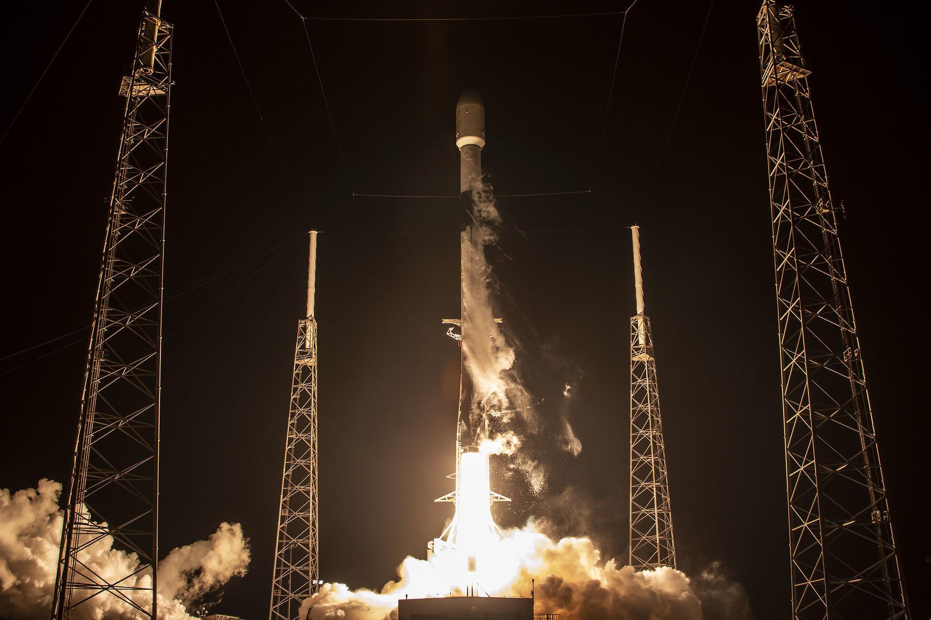
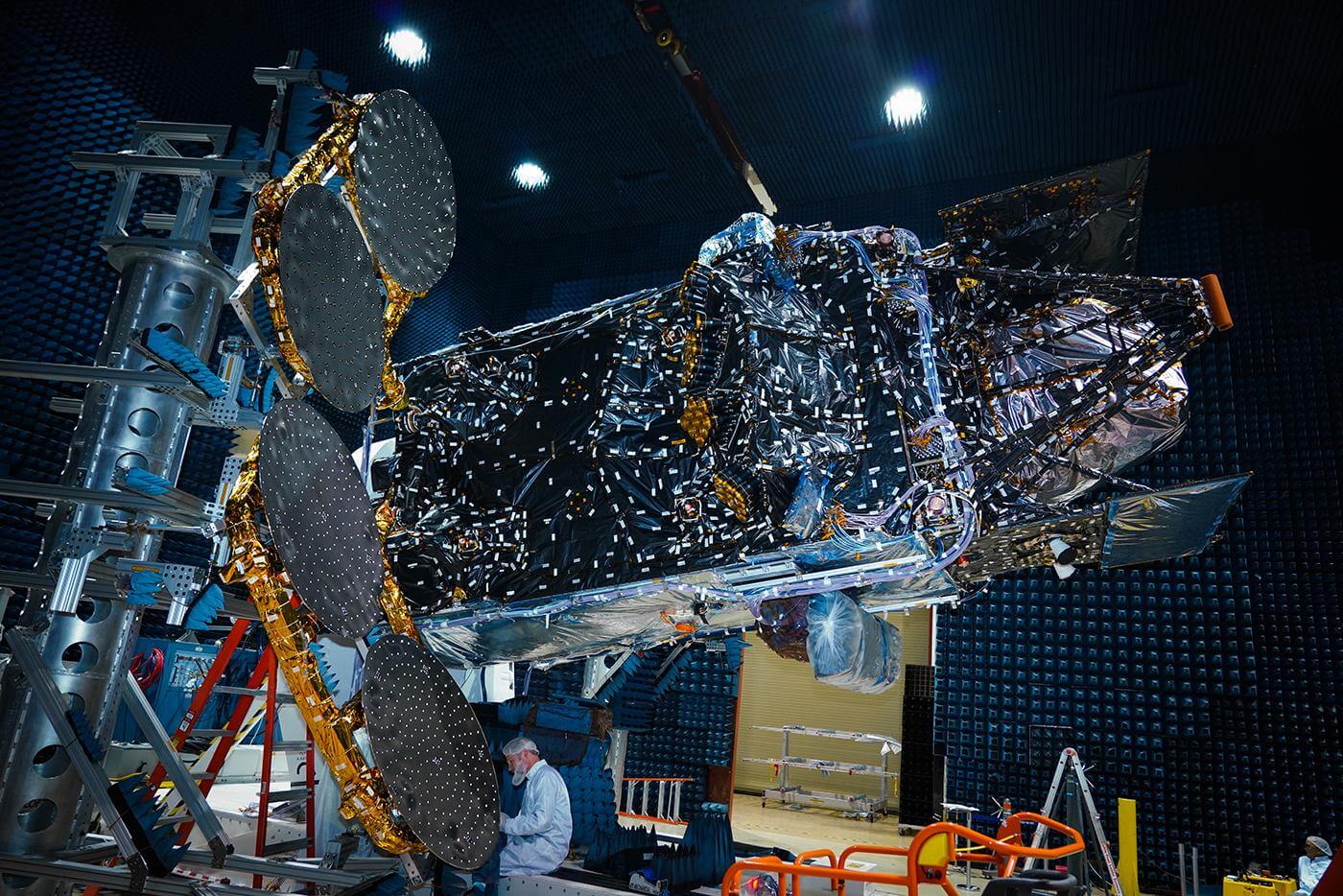
Falcon 9 Block 5 | Intelsat 40e
SpaceX | United States of AmericaCape Canaveral SFS, FL, USA
April 7, 2023, 4:30 a.m.
Status: Launch Successful
Mission:
Intelsat 40e is an advanced geostationary satellite that will provide Intelsat’s government and enterprise customers across North and Central America with high-throughput, “coast-to-coast” services. The satellite’s capabilities will support the growing number of customers that depend on Intelsat’s managed services and solutions to easily integrate satellite into their overall networking and communications strategies. Hosted on the Intelsat 40e satellite is NASA’s Tropospheric Emissions: Monitoring of Pollution (TEMPO), an Earth science instrument that will observe air pollution over North America in unprecedented detail.
Geostationary Transfer Orbit B1076 - Flight Proven ( ) A Shortfall of GravitasLong March 8A
SpaceSail Polar Group #14
Commercial LC-1 - Wenchang Space Launch Site, People's Republic of China20 Low Earth Orbit communication satellites with Ku, Q and V band payloads for the G60 constellation operated by Shanghai Spacesail Technologies with…
Falcon 9
Starlink Group 10-50
Space Launch Complex 40 - Cape Canaveral SFS, FL, USAA batch of 29 satellites for the Starlink mega-constellation - SpaceX's project for space-based Internet communication system. The Falcon 9 1st st…
Long March 6A
SpaceSail Polar Group #13
Launch Complex 9A - Taiyuan Satellite Launch Center, People's Republic of China18 Low Earth Orbit communication satellites with Ku, Q and V band payloads for the G60 constellation operated by Shanghai Spacesail Technologies with…
Pegasus XL
Swift Boost Mission
Kwajalein Atoll - Air launch to orbitContracted by NASA under the Small Business Innovation Research Phase 3 contract, Katalyst Space Technologies' LINK servicing spacecraft will rendezv…
Atlas V 551
Amazon Leo (LA-08)
Space Launch Complex 41 - Cape Canaveral SFS, FL, USAAmazon Leo, formerly known as Project Kuiper, is a mega constellation of satellites in Low Earth Orbit that will offer broadband internet access, thi…
Falcon 9
Starlink Group 17-46
Space Launch Complex 4E - Vandenberg SFB, CA, USAA batch of 24 satellites for the Starlink mega-constellation - SpaceX's project for space-based Internet communication system.
Long March 4B
Haiyang 2E
Launch Area 94 (SLS-2 / 603) - Jiuquan Satellite Launch Center, People's Republic of ChinaHaiyang 2E (Chinese: "Ocean"), abbreviated HY-2E, is a marine remote sensing satellite of China. The HY-2 series' primary objective is to measure oce…
Falcon 9
Sirius SXM-11
Space Launch Complex 40 - Cape Canaveral SFS, FL, USASXM-11 is the 12th high-powered, digital, audio radio satellite built by Lanteris Space (ex-Maxar, Space System/Loral) for SiriusXM. The SXM-11 satel…
Falcon 9
Starlink Group 17-40
Space Launch Complex 4E - Vandenberg SFB, CA, USAA batch of 24 satellites for the Starlink mega-constellation - SpaceX's project for space-based Internet communication system.
Electron
Ten Owl Of Ten (StriX Launch 10)
Rocket Lab Launch Complex 1B - Rocket Lab Launch Complex 1, Mahia Peninsula, New ZealandSynthetic aperture radar satellite for Japanese Earth imaging company Synspective.

