Press Event
NASA SWOT Pre-Launch Briefing
Falcon 9 Block 5 | SWOT (Surface Water and Ocean Topography)
NASA will hold a media briefing ahead of the launch of the Surface Water and Ocean Topography (SWOT) satellite, built in cooperation with the french space agency CNES.
Related Information
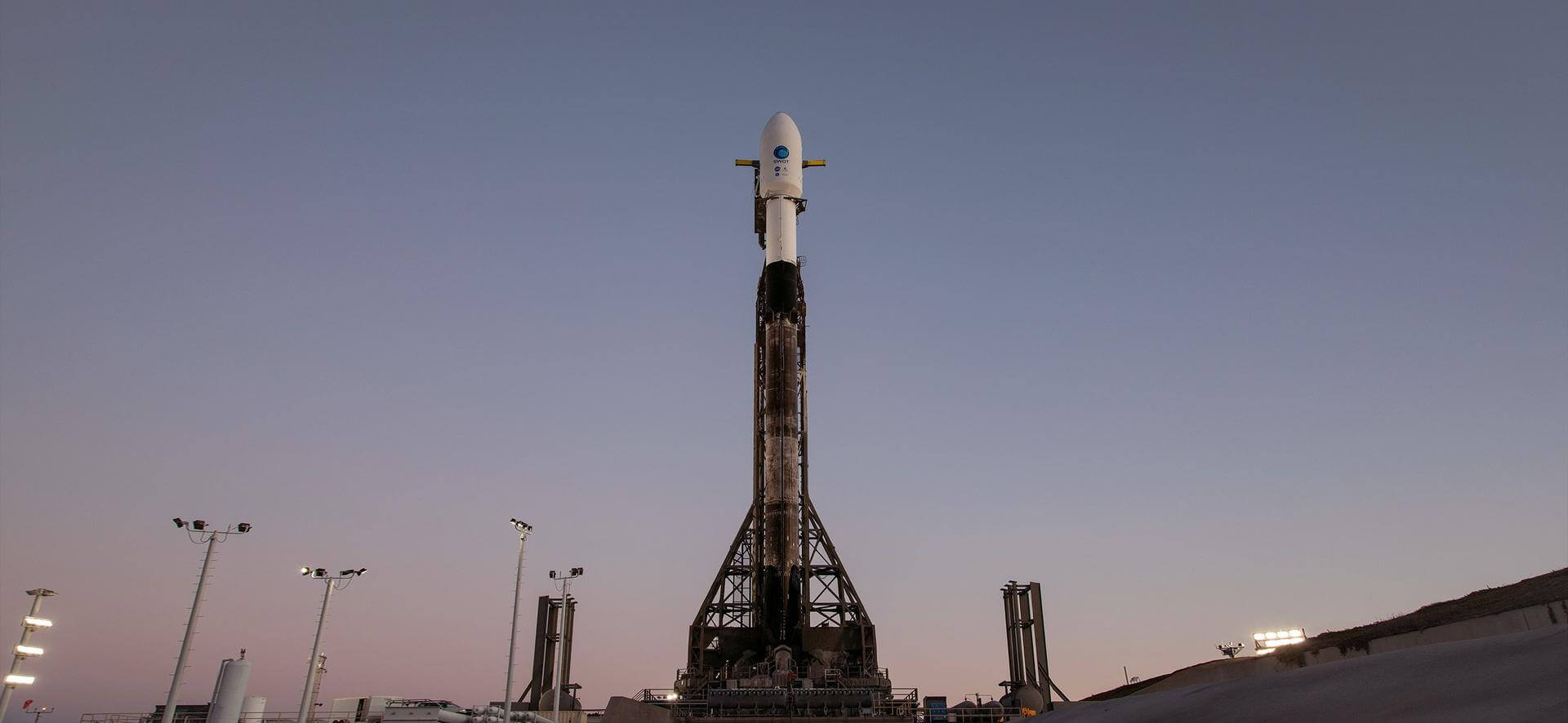
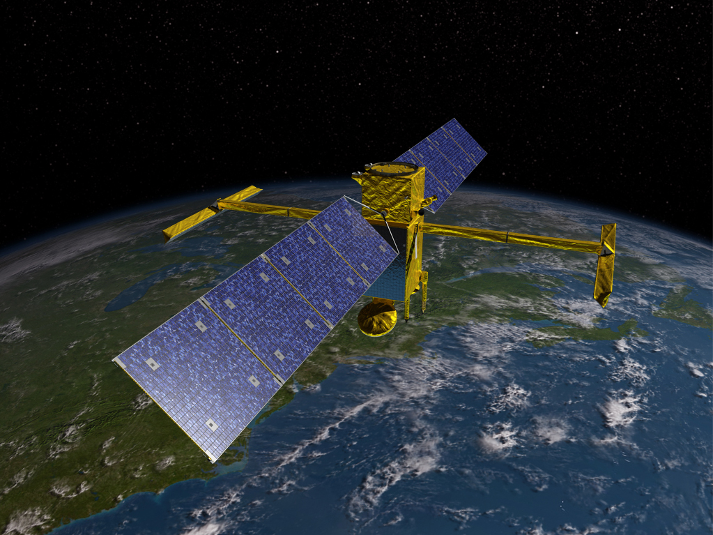
Falcon 9 Block 5 | SWOT (Surface Water and Ocean Topography)
SpaceX | United States of AmericaVandenberg SFB, CA, USA
Dec. 16, 2022, 11:46 a.m.
Status: Launch Successful
Mission:
Satellite altimeter jointly developed by NASA and CNES, the French space agency, in partnership with the Canadian Space Agency (CSA) and UK Space Agency (UKSA) designed to make the first global survey of the Earth's surface water, to observe the fine details of the ocean surface topography, and to measure how terrestrial surface water bodies change over time.
Low Earth Orbit B1071 - Flight Proven ( ) Landing Zone 4Falcon 9
Starlink Group 10-25
Space Launch Complex 40 - Cape Canaveral SFS, FL, USAA batch of 27 satellites for the Starlink mega-constellation - SpaceX's project for space-based Internet communication system.
Falcon 9
MTG-S1
Launch Complex 39A - Kennedy Space Center, FL, USASecond of EUMETSAT's third generation of weather satellite.
New Shepard
NS-33
West Texas Suborbital Launch Site/ Corn Ranch - Corn Ranch, Van Horn, TX, USANS-33 is the 13th crewed flight for the New Shepard program and the 33rd in its history.
Falcon 9
Starlink Group 15-7
Space Launch Complex 4E - Vandenberg SFB, CA, USAA batch of 26 satellites for the Starlink mega-constellation - SpaceX's project for space-based Internet communication system.
H-IIA
GOSAT-GW (Ibuki GW)
Yoshinobu Launch Complex LP-1 - Tanegashima Space Center, JapanGOSAT-GW (Greenhouse Gases Observing Satellite Greenhouse gases and Water cycle), also known as Ibuki GW and formerly known as GOSAT 3, is JAXA's nex…
Electron
Symphony In The Stars
Rocket Lab Launch Complex 1B - Rocket Lab Launch Complex 1, Mahia Peninsula, New Zealand'Symphony In The Stars' is the first of two dedicated missions on Electron to deploy a single spacecraft to a 650km circular Earth orbit for a confid…
Falcon 9
Starlink Group 10-34
Space Launch Complex 40 - Cape Canaveral SFS, FL, USAA batch of 27 satellites for the Starlink mega-constellation - SpaceX's project for space-based Internet communication system.
Electron
Get The Hawk Outta Here (4x HawkEye 360)
Rocket Lab Launch Complex 1A - Rocket Lab Launch Complex 1, Mahia Peninsula, New ZealandHawkEye 360 is a a space-based civil global intelligence satellite network using radio frequency (RF) technology to help monitor transportation acros…
Falcon 9
Starlink Group 10-16
Space Launch Complex 40 - Cape Canaveral SFS, FL, USAA batch of 27 satellites for the Starlink mega-constellation - SpaceX's project for space-based Internet communication system.
Falcon 9
Axiom Space Mission 4
Launch Complex 39A - Kennedy Space Center, FL, USAThis is a Crew Dragon flight for a private company Axiom Space. The mission will carry a professionally trained commander alongside three private ast…

