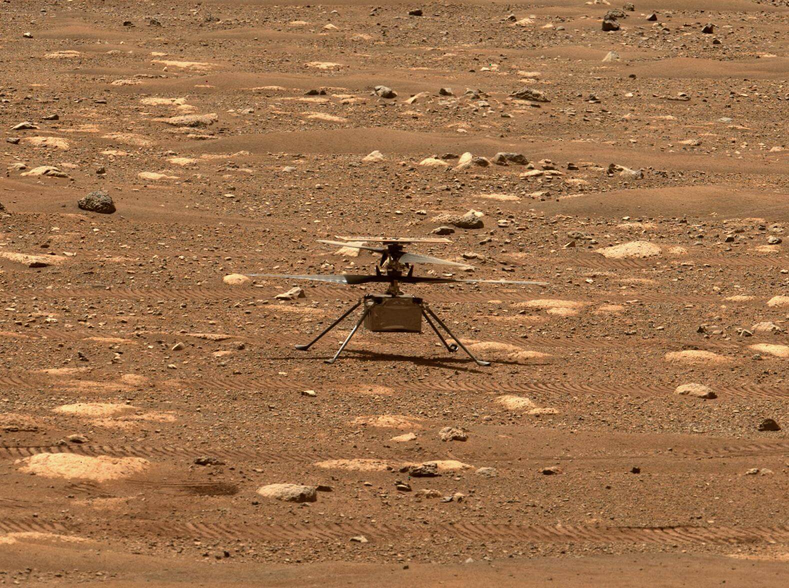
Test Flight
NASA Mars 2020 Ingenuity Sixth Flight
Airfield B, Jezero crater, Mars Atlas V 541 | Mars 2020 (Perseverance rover & Ingenuity helicopter)
On the 91st Martian day, or sol, of NASA’s Mars 2020 Perseverance rover mission, the Ingenuity Mars Helicopter performed its sixth flight. The flight was designed to expand the flight envelope and demonstrate aerial-imaging capabilities by taking stereo images of a region of interest to the west. Ingenuity was commanded to climb to an altitude of 33 feet (10 meters) before translating 492 feet (150 meters) to the southwest at a ground speed of 9 mph (4 meters per second). At that point, it was to translate 49 feet (15 meters) to the south while taking images toward the west, then fly another 164 feet (50 meters) northeast and land.
Telemetry from Flight Six shows that the first 150-meter leg of the flight went off without a hitch. But toward the end of that leg, something happened: Ingenuity began adjusting its velocity and tilting back and forth in an oscillating pattern. This behavior persisted throughout the rest of the flight. Prior to landing safely, onboard sensors indicated the rotorcraft encountered roll and pitch excursions of more than 20 degrees, large control inputs, and spikes in power consumption.
Despite encountering this anomaly, Ingenuity was able to maintain flight and land safely on the surface within approximately 16 feet (5 meters) of the intended landing location.
Updates
spacelaunchnowadmin • May 27, 2021, 8:11 p.m.
Ingenuity's sixth flight encountered an anomaly during flight - the vehicle was able to recover and safely land however an issue in its navigation camera caused unreliable navigation information that resulted in oscillations during flight.
Related Information
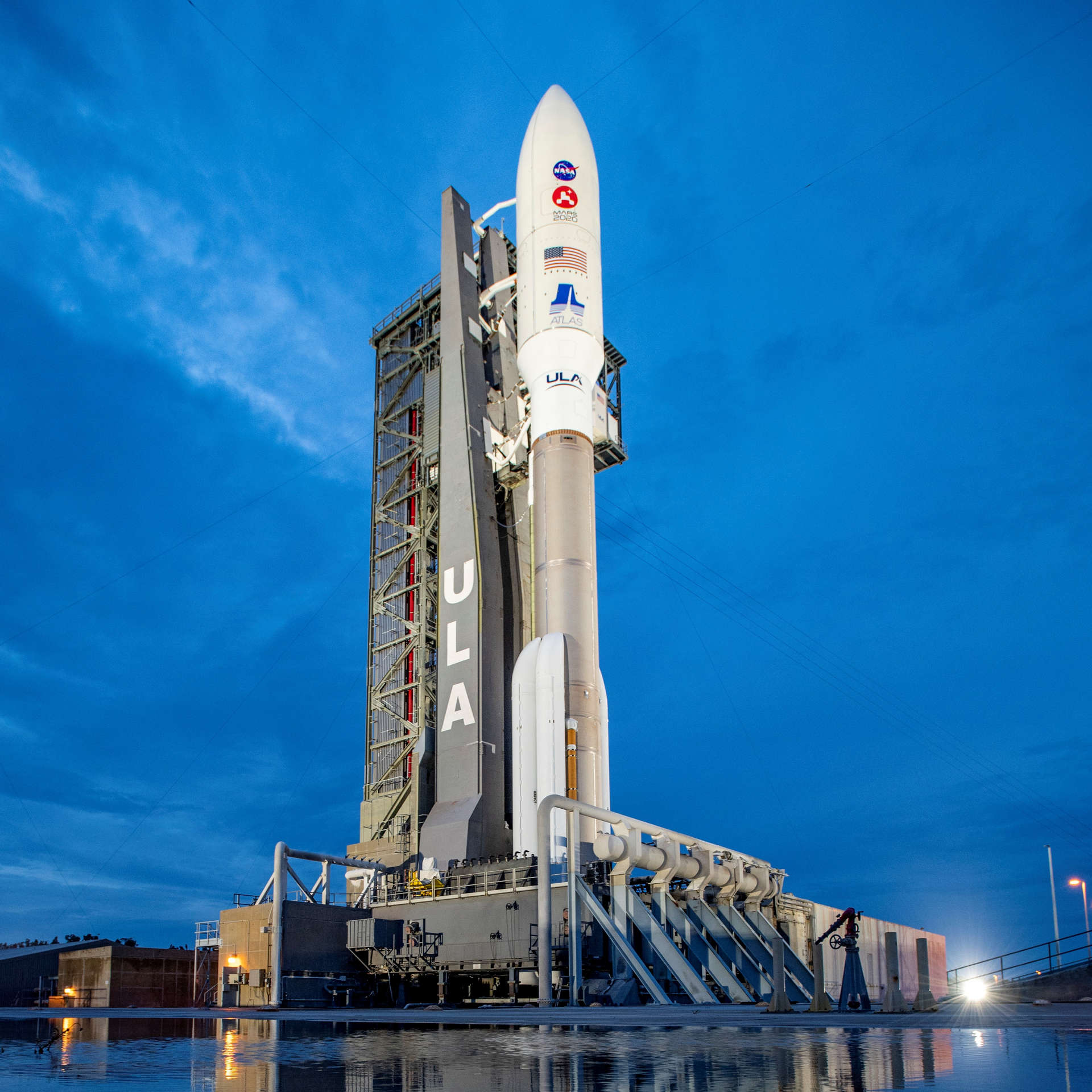
Atlas V 541 | Mars 2020 (Perseverance rover & Ingenuity helicopter)
United Launch Alliance | United States of AmericaCape Canaveral SFS, FL, USA
July 30, 2020, 11:50 a.m.
Status: Launch Successful
Mission:
Atop this ULA Atlas V rocket will be Perseverance, a car-sized rover which will explore an ancient river delta on Mars. Armed with a suite of six scientific instruments, Perseverance will primarily hunt for clues to the planet's distant past, and hopefully uncover signs of ancient life and habitability. The rover also carries an experiment that'll convert carbon dioxide into oxygen, a box-sized helicopter named Ingenuity that'll demonstrate powered flight on Mars, and a system that enables the rover to leave behind samples for later retrieval and return to Earth during NASA and ESA's ambitious sample return mission later this decade.
Heliocentric N/ALong March 8A
SpaceSail Polar Group #14
Commercial LC-1 - Wenchang Space Launch Site, People's Republic of China20 Low Earth Orbit communication satellites with Ku, Q and V band payloads for the G60 constellation operated by Shanghai Spacesail Technologies with…
Falcon 9
Starlink Group 10-50
Space Launch Complex 40 - Cape Canaveral SFS, FL, USAA batch of 29 satellites for the Starlink mega-constellation - SpaceX's project for space-based Internet communication system. The Falcon 9 1st st…
Long March 6A
SpaceSail Polar Group #13
Launch Complex 9A - Taiyuan Satellite Launch Center, People's Republic of China18 Low Earth Orbit communication satellites with Ku, Q and V band payloads for the G60 constellation operated by Shanghai Spacesail Technologies with…
Pegasus XL
Swift Boost Mission
Kwajalein Atoll - Air launch to orbitContracted by NASA under the Small Business Innovation Research Phase 3 contract, Katalyst Space Technologies' LINK servicing spacecraft will rendezv…
Atlas V 551
Amazon Leo (LA-08)
Space Launch Complex 41 - Cape Canaveral SFS, FL, USAAmazon Leo, formerly known as Project Kuiper, is a mega constellation of satellites in Low Earth Orbit that will offer broadband internet access, thi…
Falcon 9
Starlink Group 17-46
Space Launch Complex 4E - Vandenberg SFB, CA, USAA batch of 24 satellites for the Starlink mega-constellation - SpaceX's project for space-based Internet communication system.
Long March 4B
Haiyang 2E
Launch Area 94 (SLS-2 / 603) - Jiuquan Satellite Launch Center, People's Republic of ChinaHaiyang 2E (Chinese: "Ocean"), abbreviated HY-2E, is a marine remote sensing satellite of China. The HY-2 series' primary objective is to measure oce…
Falcon 9
Sirius SXM-11
Space Launch Complex 40 - Cape Canaveral SFS, FL, USASXM-11 is the 12th high-powered, digital, audio radio satellite built by Lanteris Space (ex-Maxar, Space System/Loral) for SiriusXM. The SXM-11 satel…
Falcon 9
Starlink Group 17-40
Space Launch Complex 4E - Vandenberg SFB, CA, USAA batch of 24 satellites for the Starlink mega-constellation - SpaceX's project for space-based Internet communication system.
Electron
Ten Owl Of Ten (StriX Launch 10)
Rocket Lab Launch Complex 1B - Rocket Lab Launch Complex 1, Mahia Peninsula, New ZealandSynthetic aperture radar satellite for Japanese Earth imaging company Synspective.

